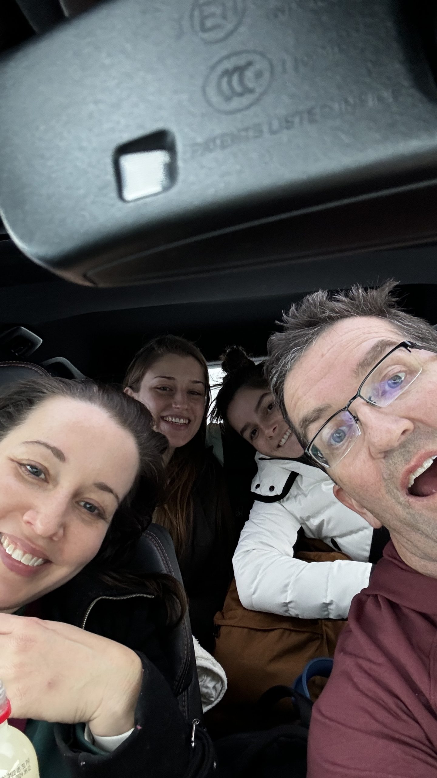
This year (2023) we are spending the first week on Kauai – to do the Kalalau trail… Week two is on Maui for Kristin’s conference… and recovery maybe!
This is not a guide for the Kalalau trail, there are many detailed guides on the trail, this is just a bit of our story with some photos and a description of our experience.
For permits and actual park information – it changes often, start here – The Napali Coast Wilderness State Park website. https://dlnr.hawaii.gov/dsp/parks/kauai/napali-coast-state-wilderness-park/
Everything from park permits to parking can be done online.
Part 1 – The beginning
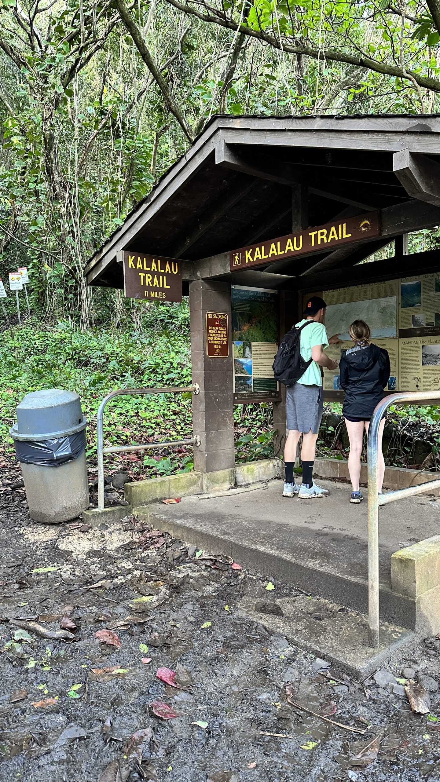
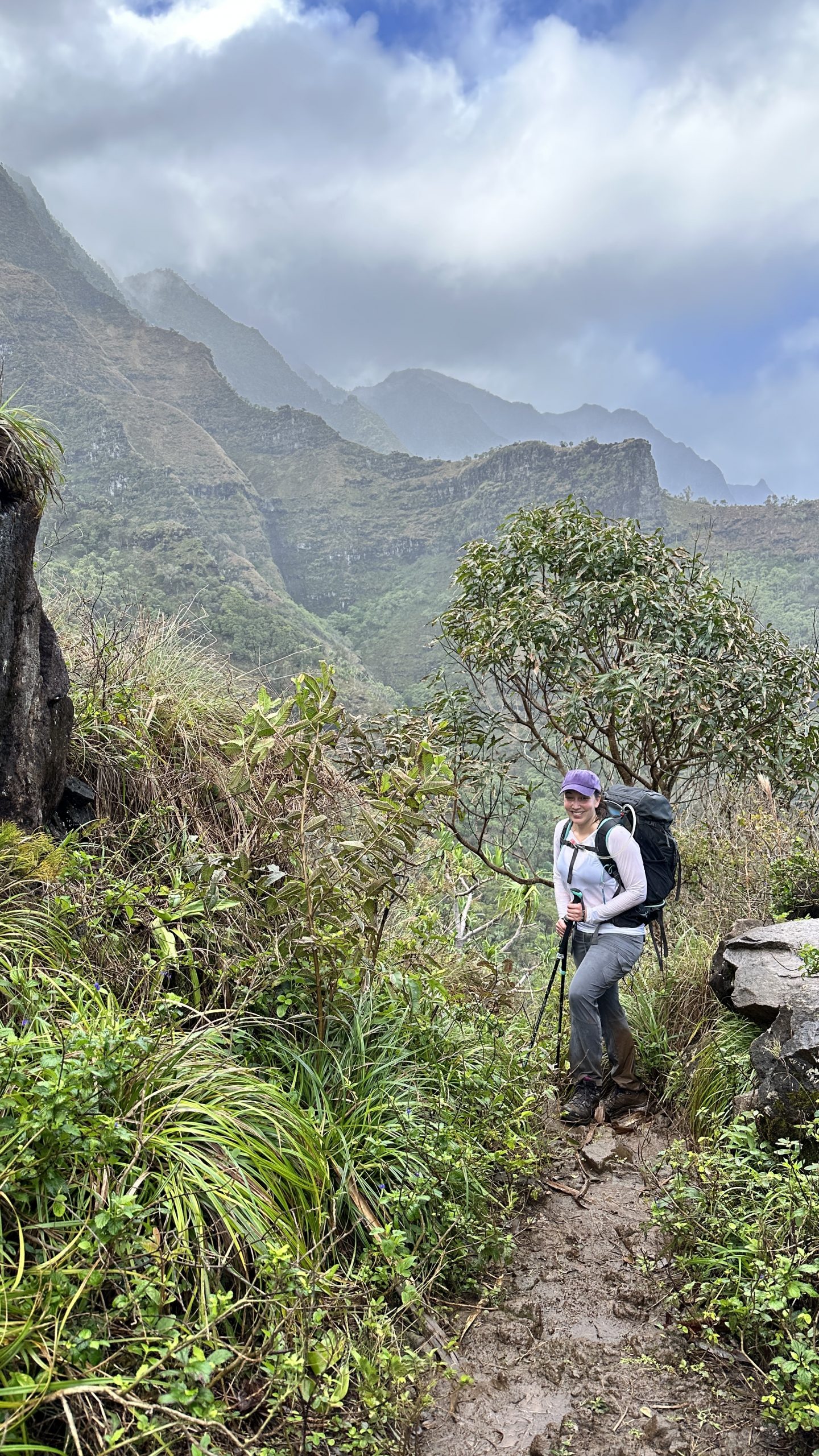
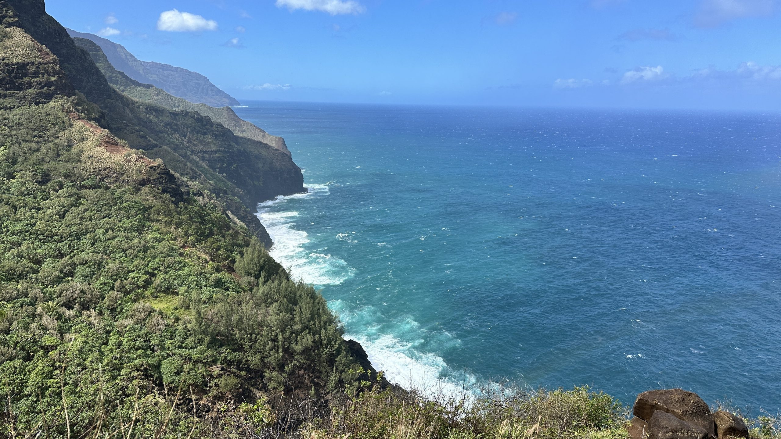
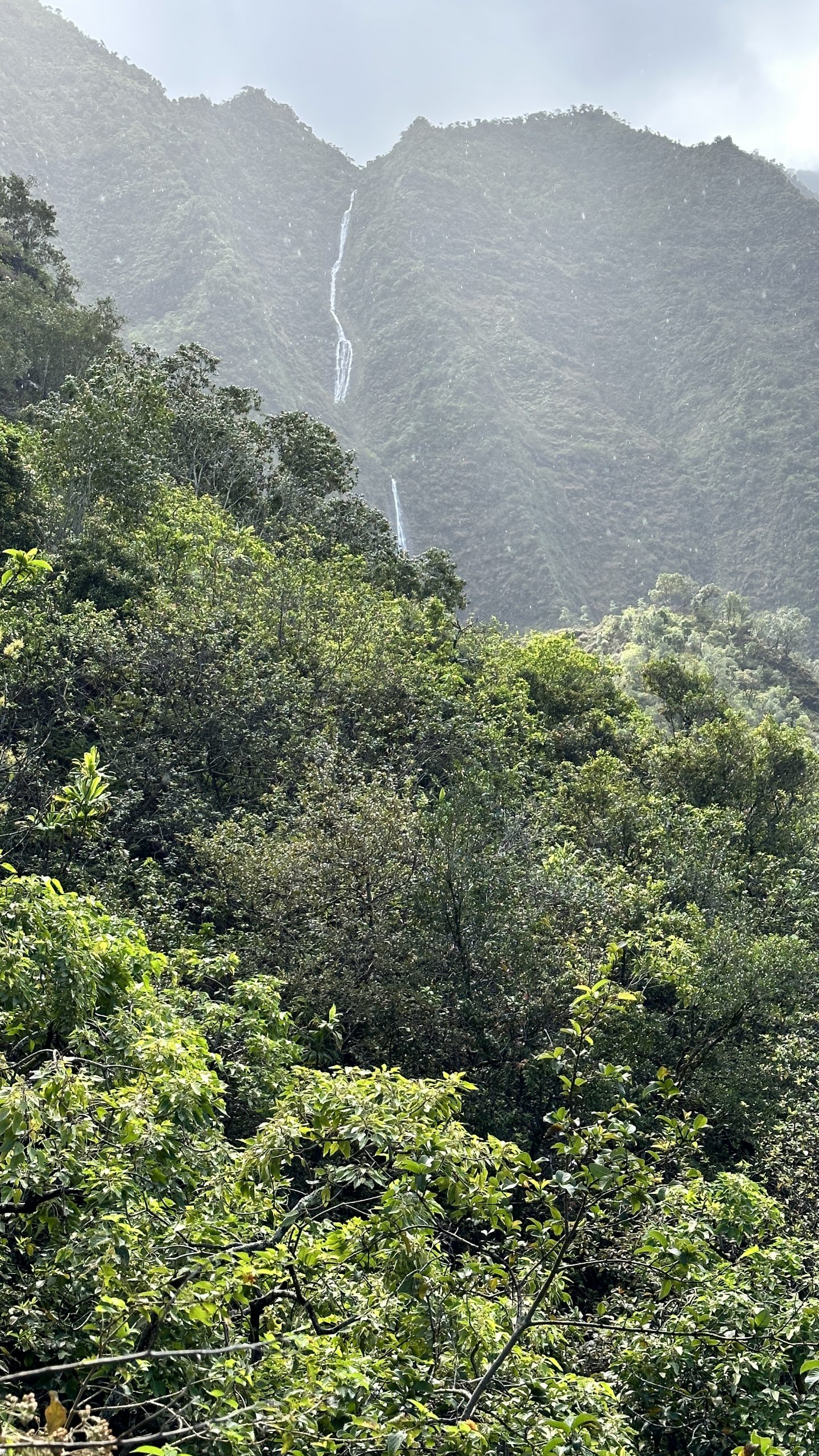
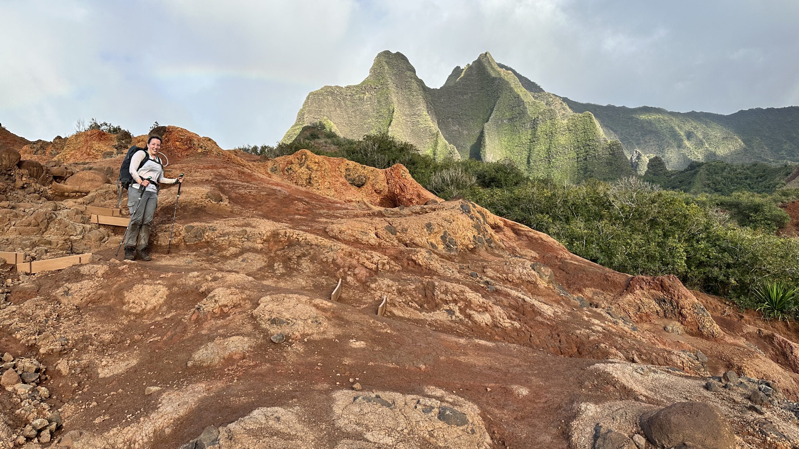
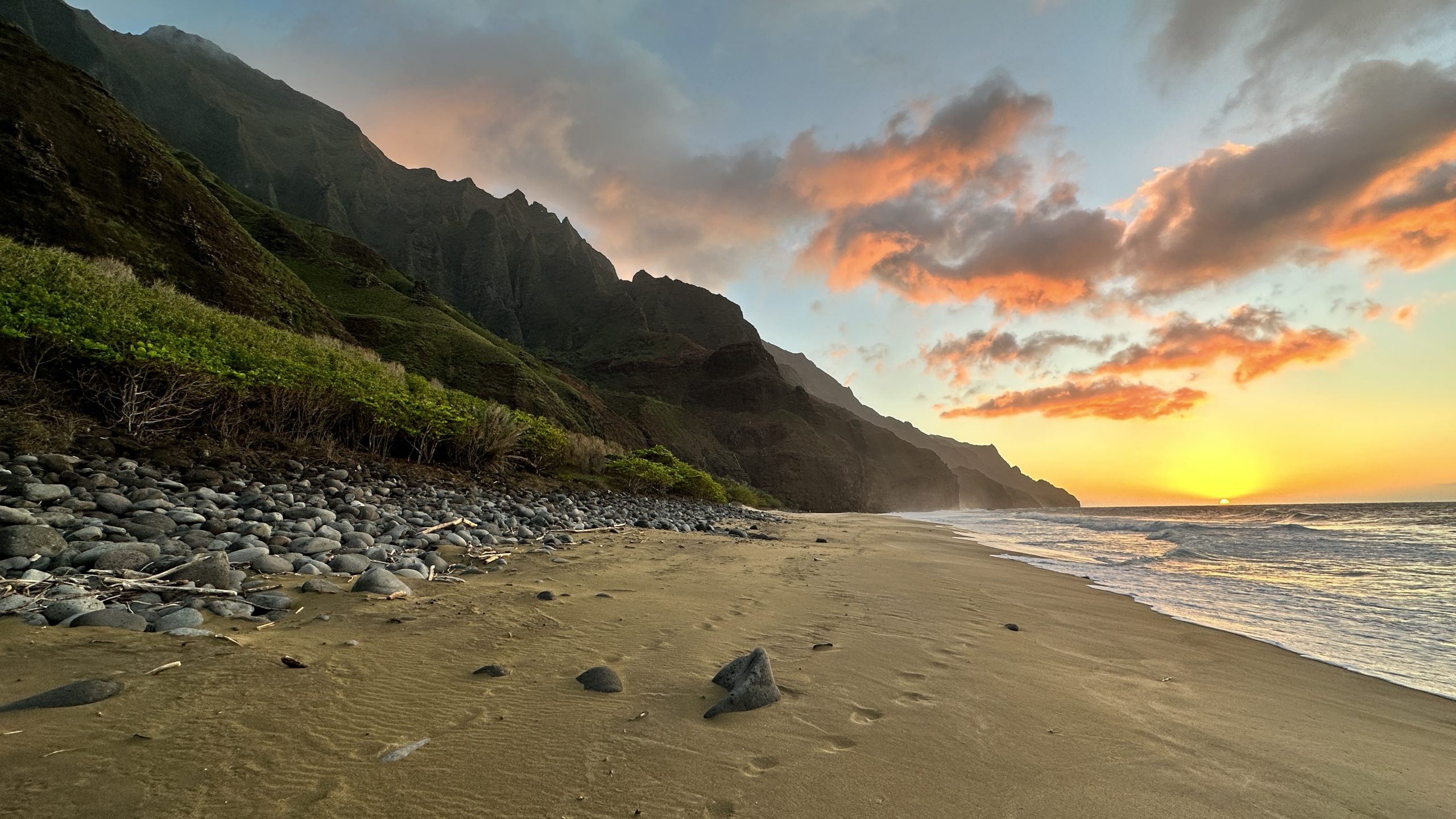
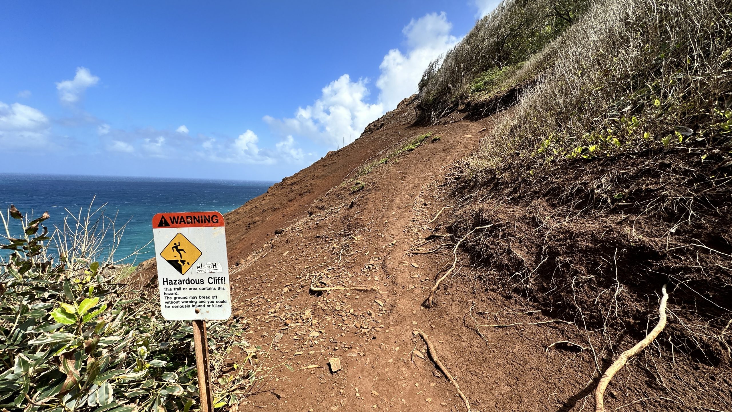
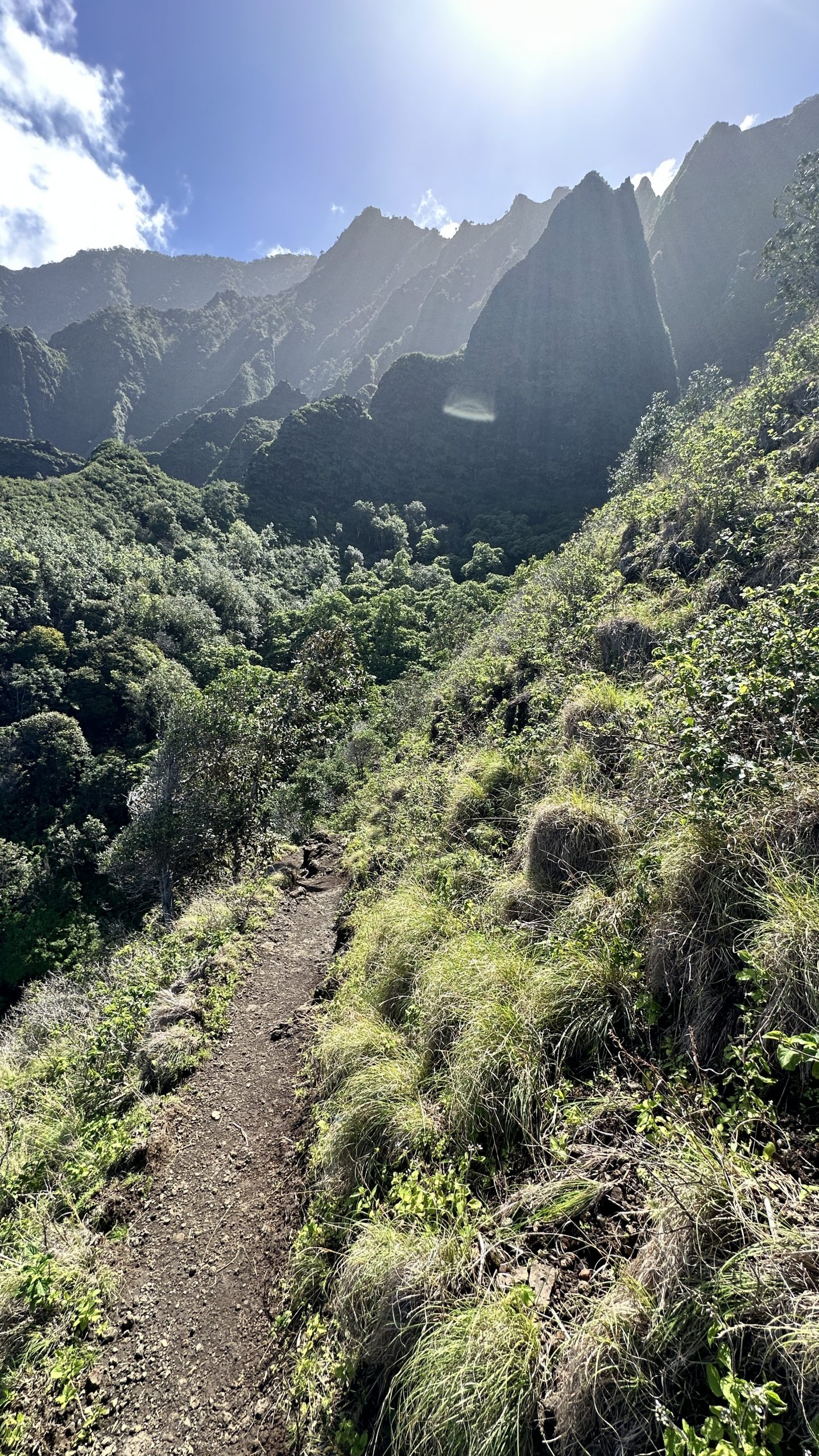
The Kalalau Trail is on the Hawaiian island of Kauai. Roughly 11 miles in length from start to finish as it oulines the Na’apali coast. No shortage of switchbacks, elevation changes and exposure.

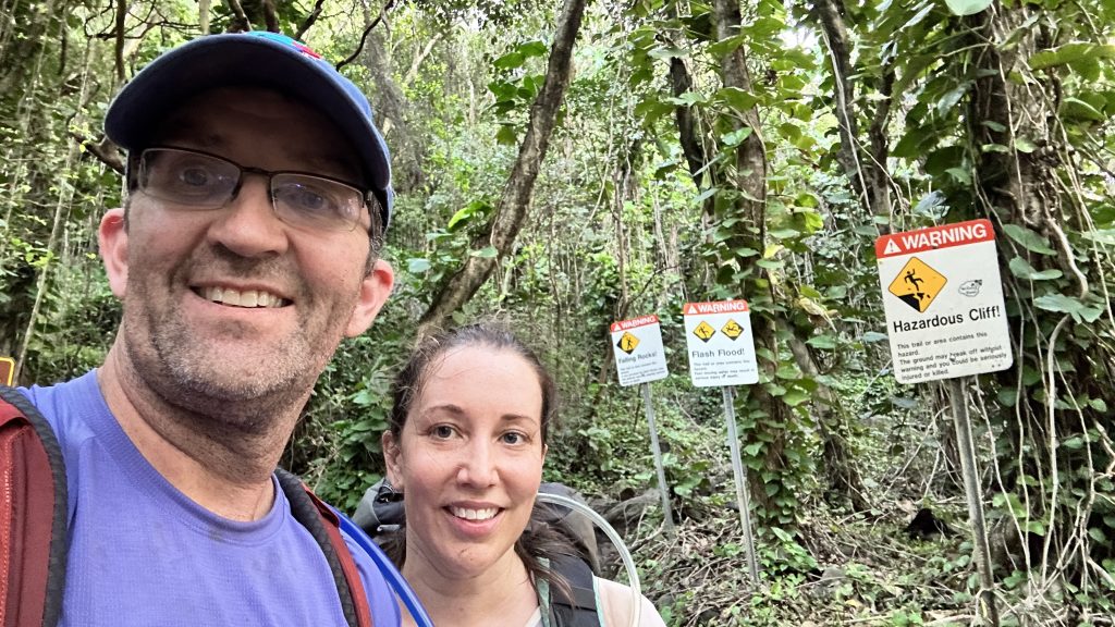
While “Crawlers Ledge” optically is probably the most dangerous section – just past mile 7 on the way in, more people apparently die in the three river crossings and by swimming at the beach during the wrong time of year.
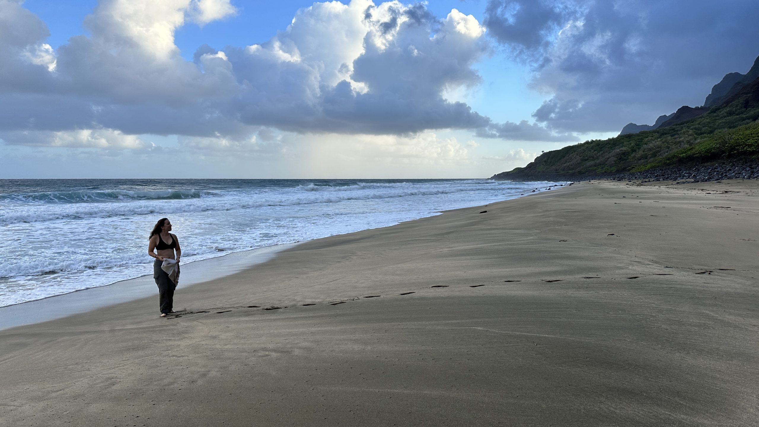
The river crossings are susceptible to flash flooding; the surf while we were there was just plain violent and that is coming from someone who is pretty comfortable in big water.
The Kalalau trail makes many lists for “Most beautiful hike” and “Most dangerous hike”. Fair!
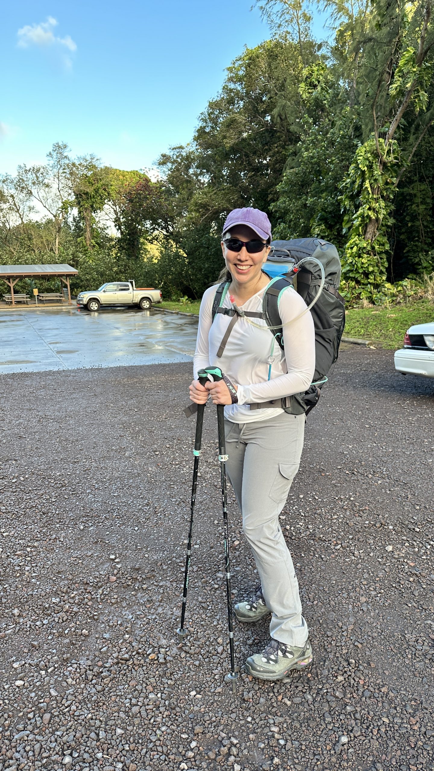
Kristin had spent time on Kauai one summer and the weather was calm; she completed the first couple of miles of the trail, in which a permit is not needed. She remembered how beautiful it was and thought it would be a good idea to do the complete trail someday!
That Someday was the end of February 2023!
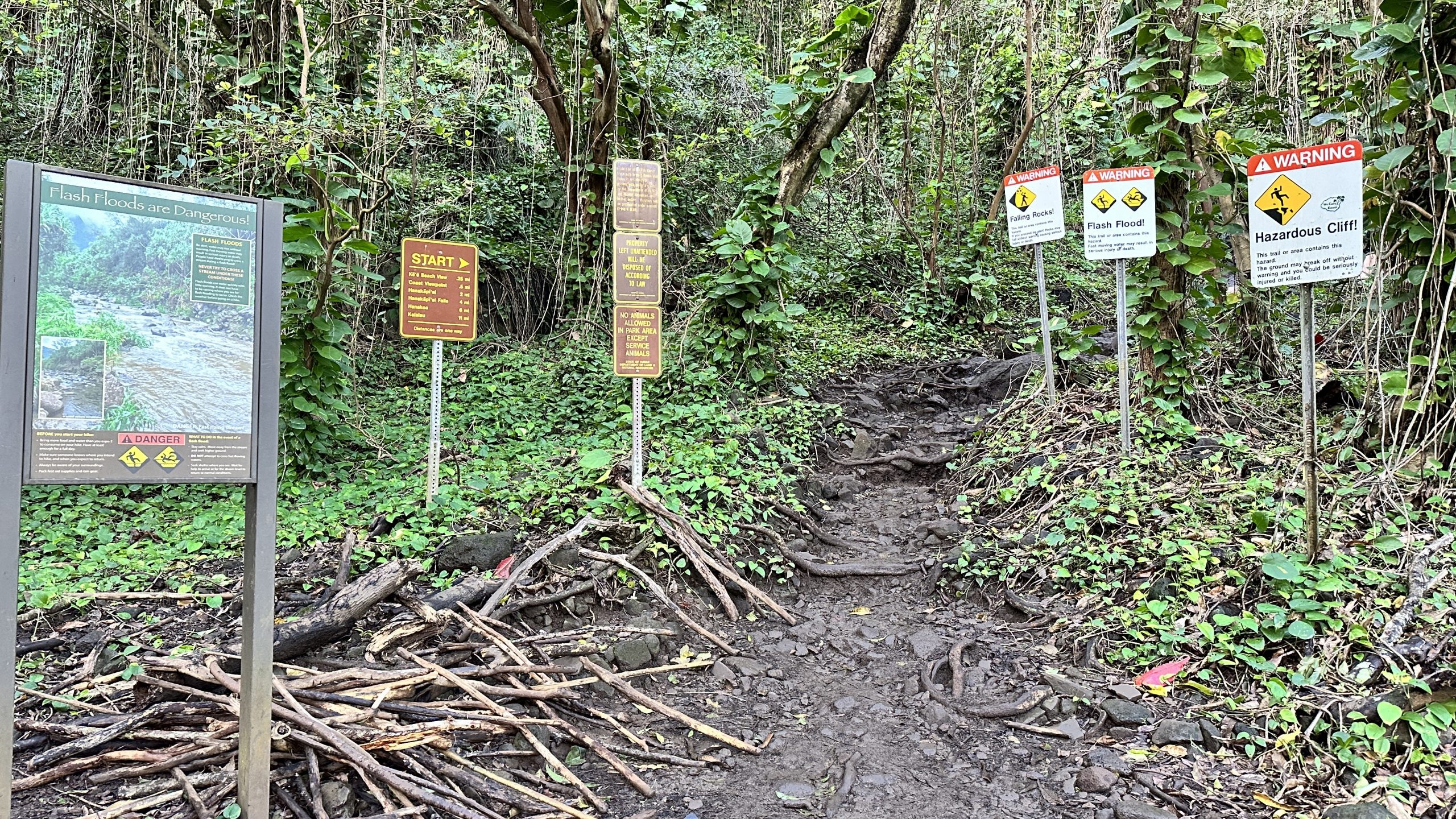
A permit is required and can be reserved online. A permit is also needed if you plan to park a car at the trailhead. Permits and parking can be reserved up to 90 days in advance.
We reserved a permit for five days, feeling that if we encountered bad weather we could adjust our start day for better weather. As it turns out, winter weather in Kauai changes every 20 minutes – we did however avoid any major weather systems and in fact the entire area had been closed due to high water 5 days before we arrived. Good fortune!
I did manage to Strava the route on the way there; however cable issues prevented me from charging up my watch to Strava the route back. The actual moving time was closer to 11 hours.
Click on the link to see the elevation profile and where we moved faster and slower and also where we got lost.
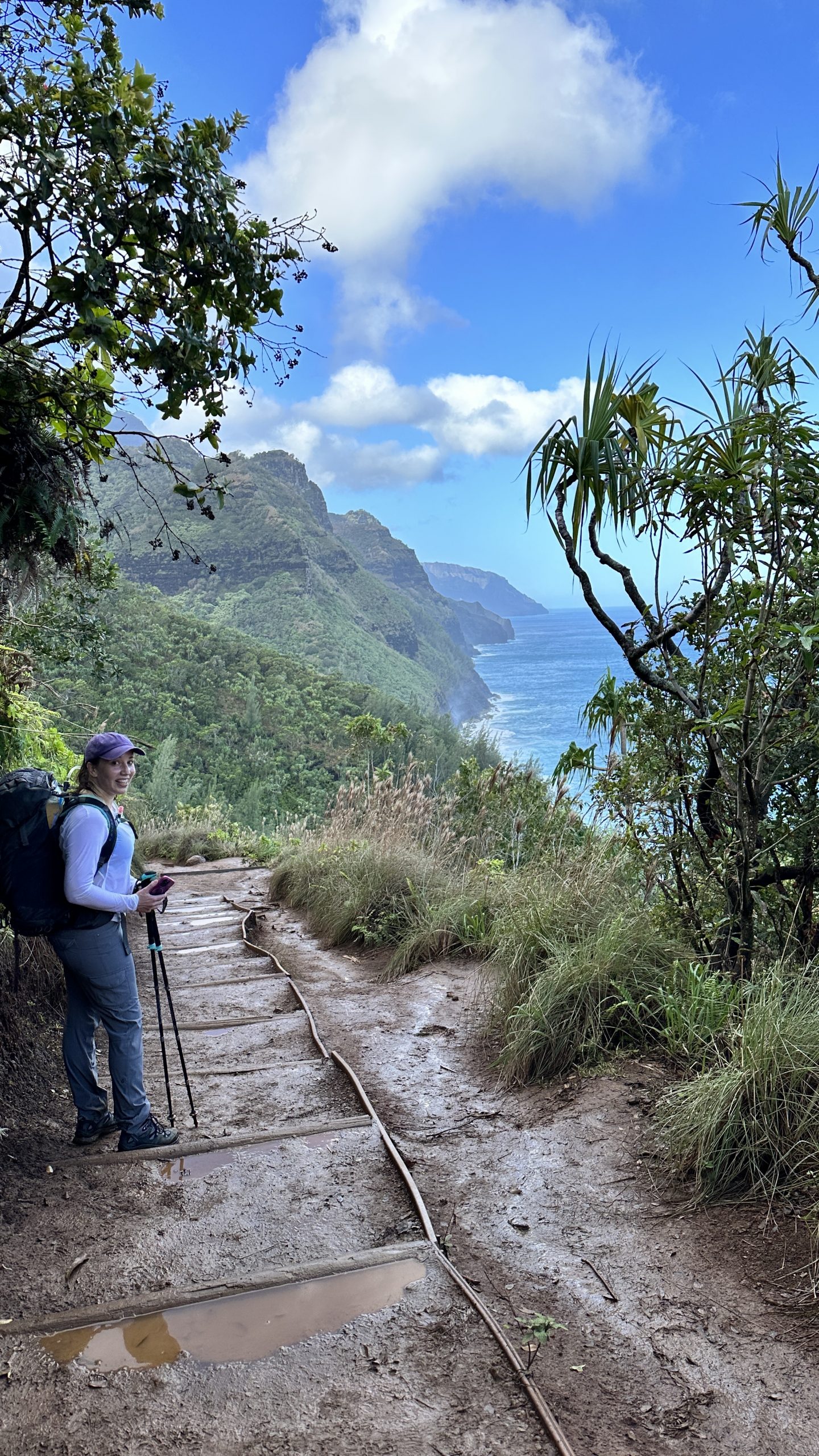
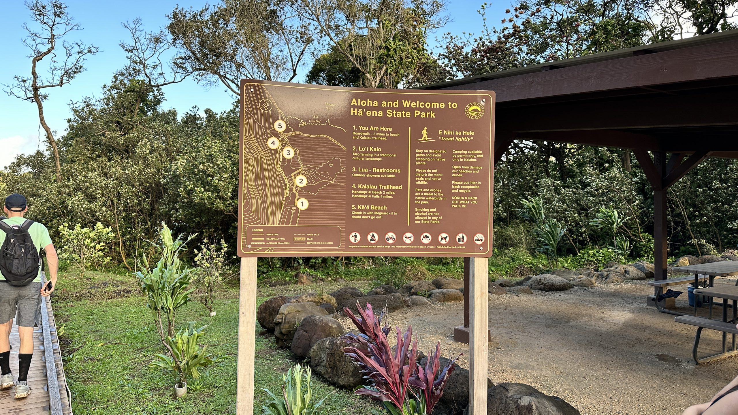
Part 1 of the trail is roughly two miles long and takes you to the first river crossing and to Hanakapi’ai Beach. During the winter there is not much beach there. It gets washed out with the current and apparently comes back in the summer!

Part 2 – The meat of the trail
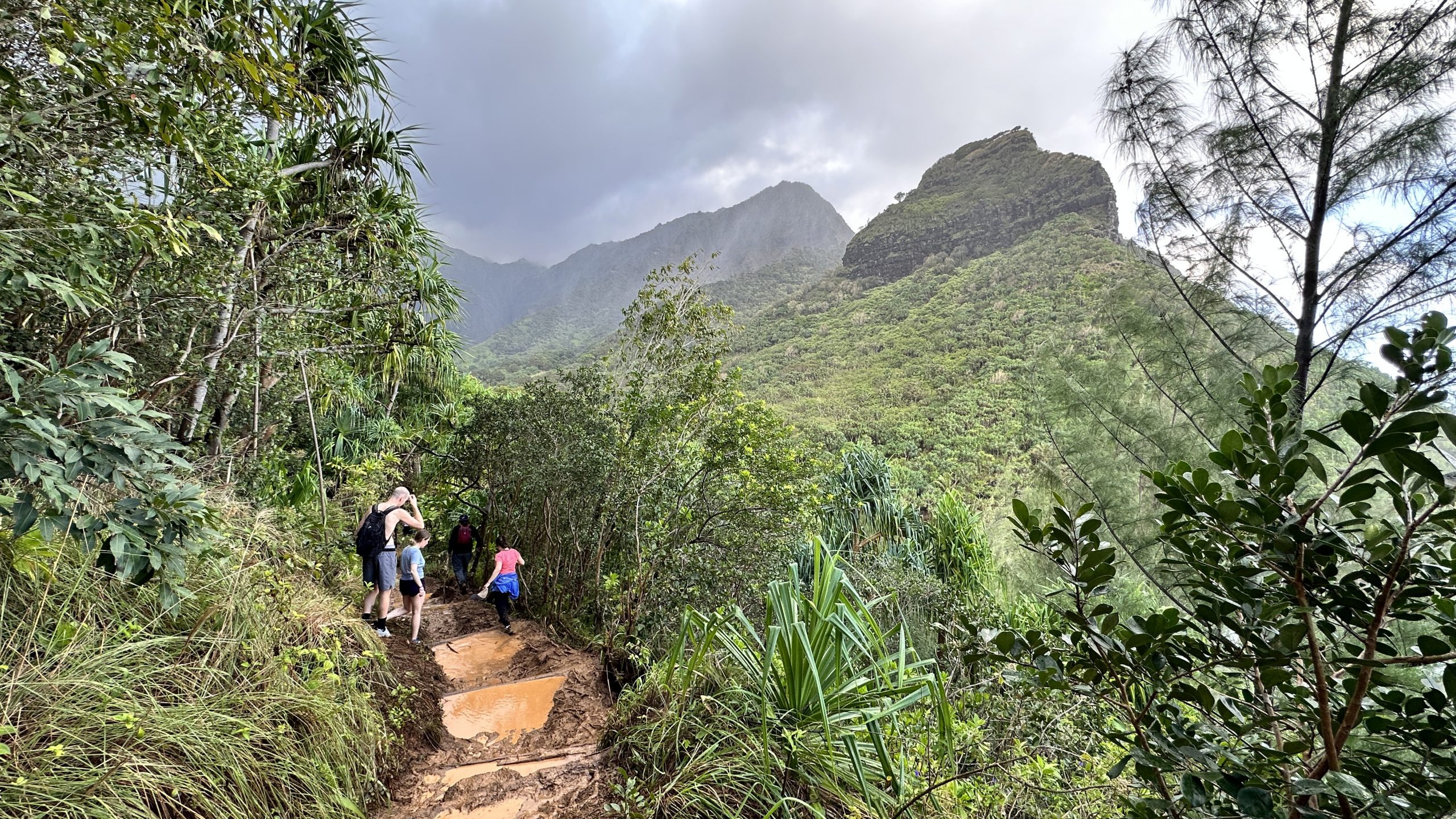
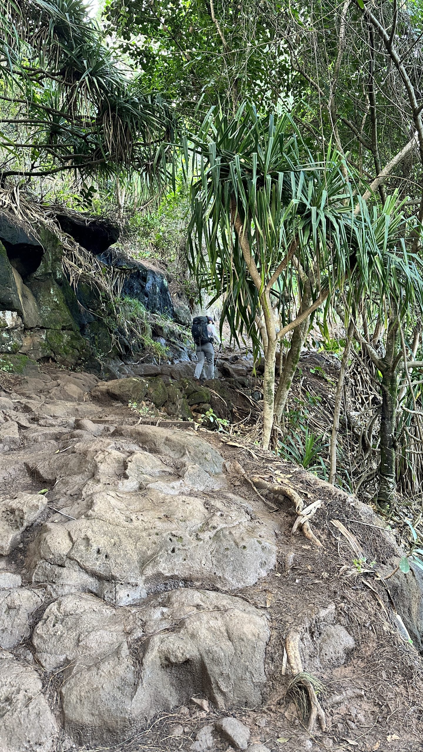
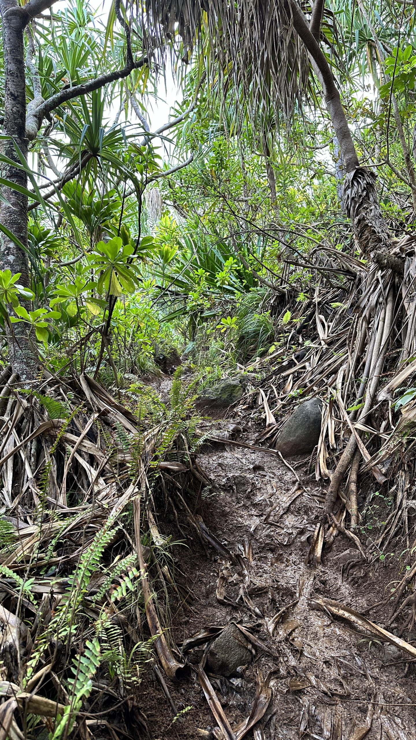
Once past the first river crossing everyone on the trail needs a permit. The first crossing was about waist deep and did not look threatening to us and we crossed in short order. From here the trail narrows and gets a bit more rough, more muddy, more wind, more up and down. In addition you are now largely on your own.
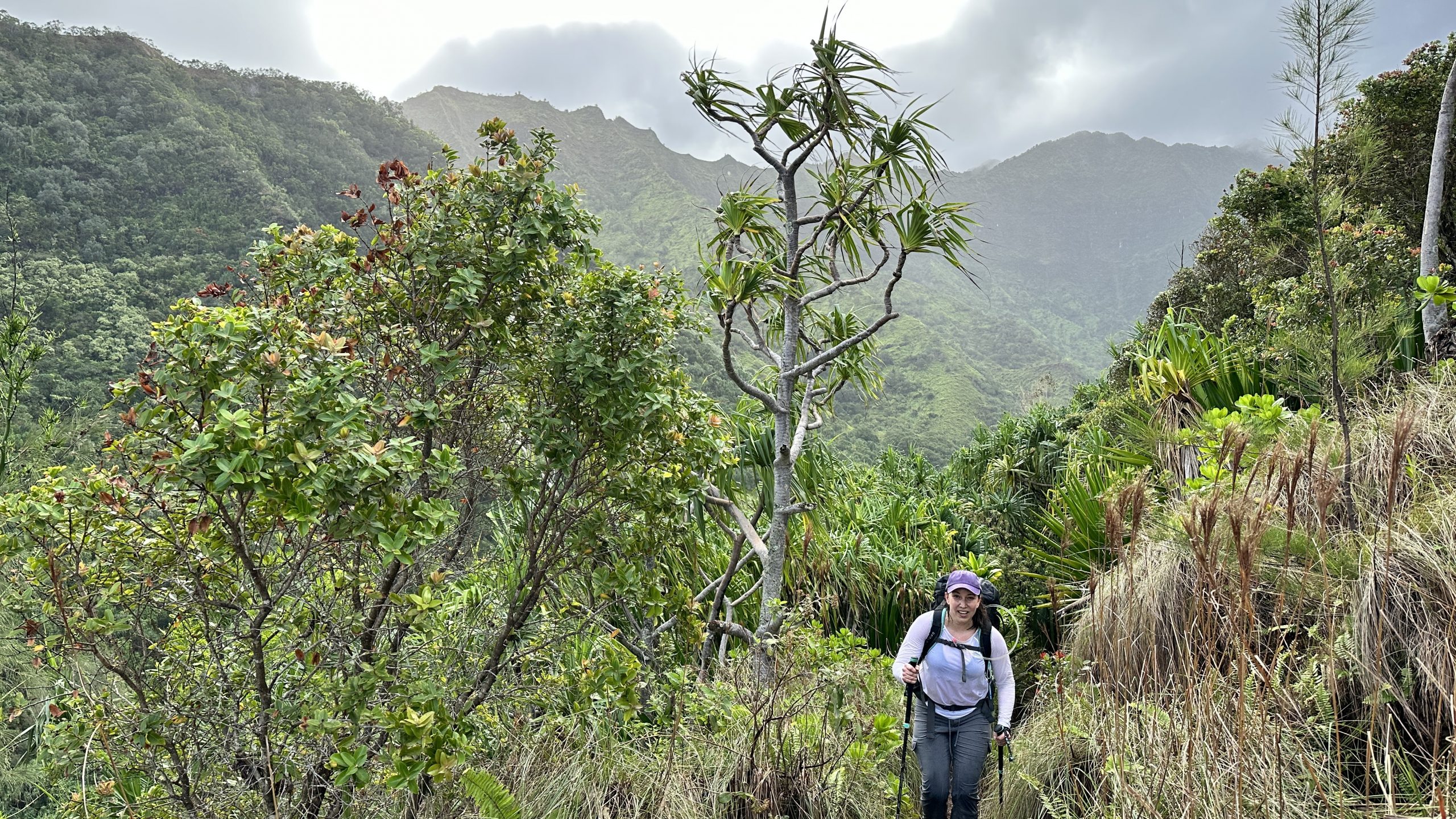
Throughout these miles we were somewhat battered by the weather. Turning inland would shelter us from the wind but as we approached any point along the water, a very strong wind would buffet us, in addition to wave upon wave of rain.
The rain was never the soaking kind but given you have a long day and are camping at the end of it, the idea of setting up wet and in the rain is never a pleasant one; for me, it played on my mind.
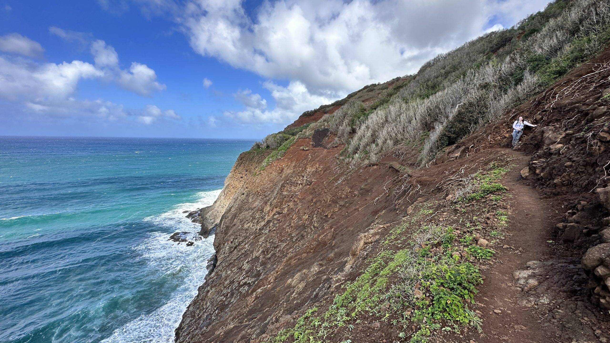
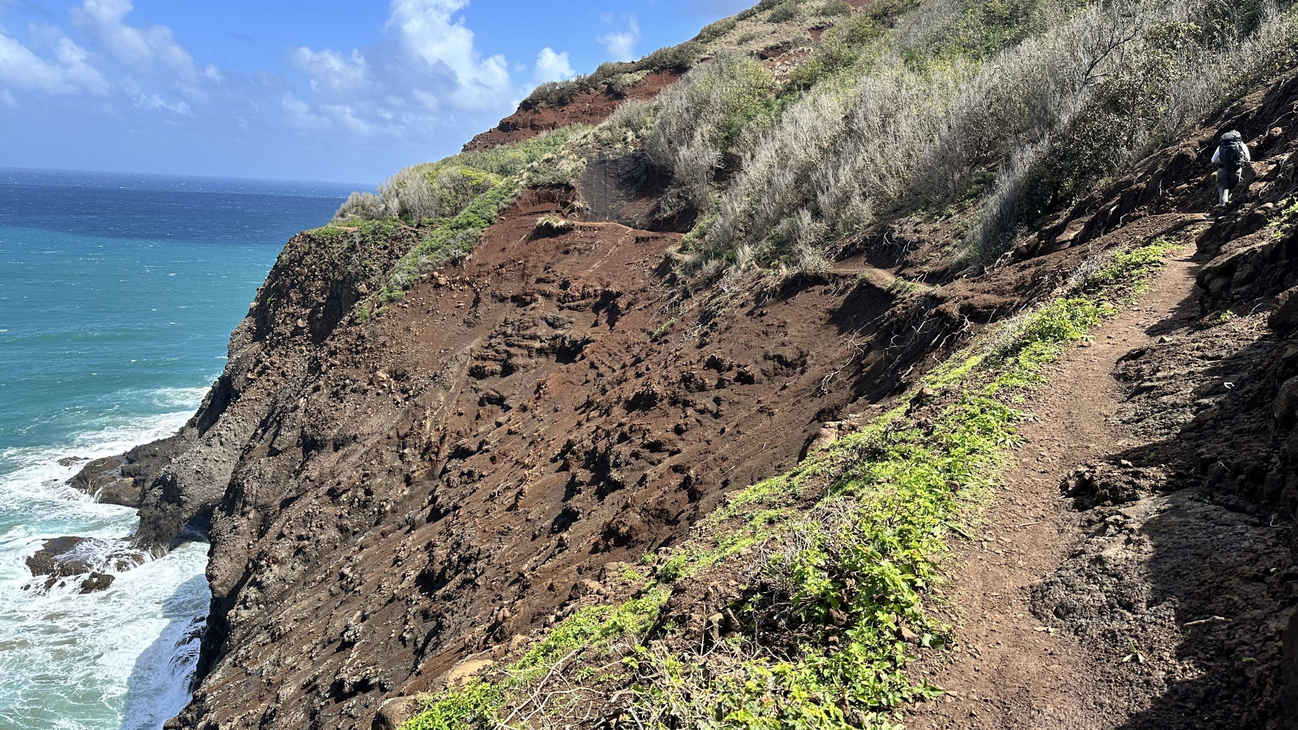
Mile 4 to 5 is terrible. It’s muddy, it’s slippery and the angle of the trail is constantly trying to push you off the edge.
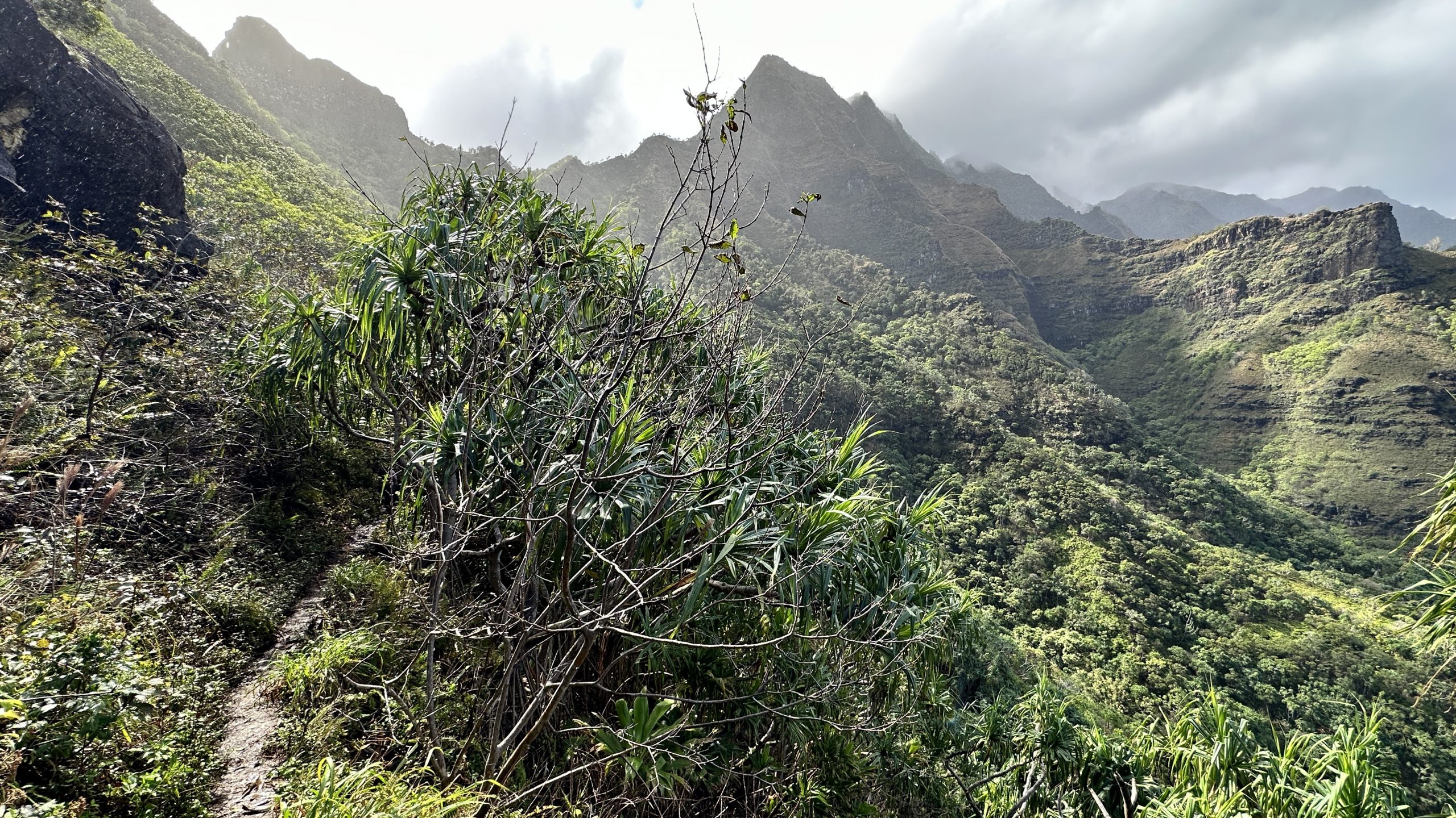
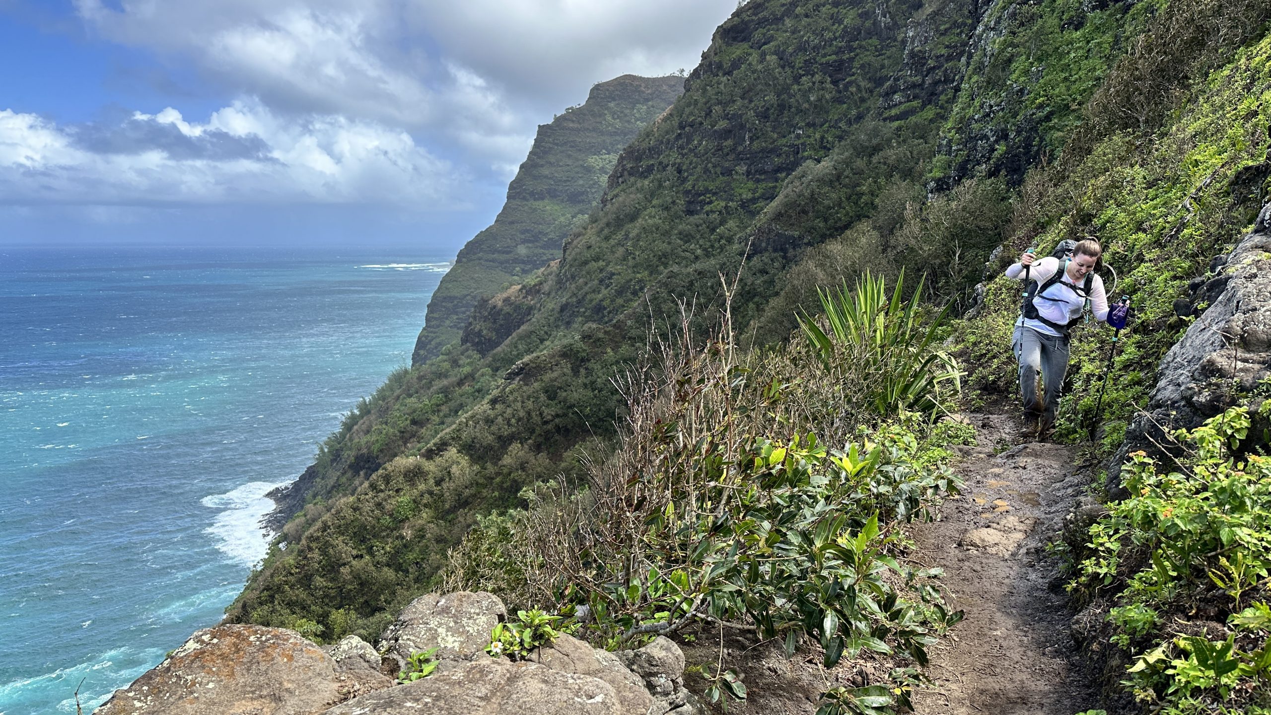
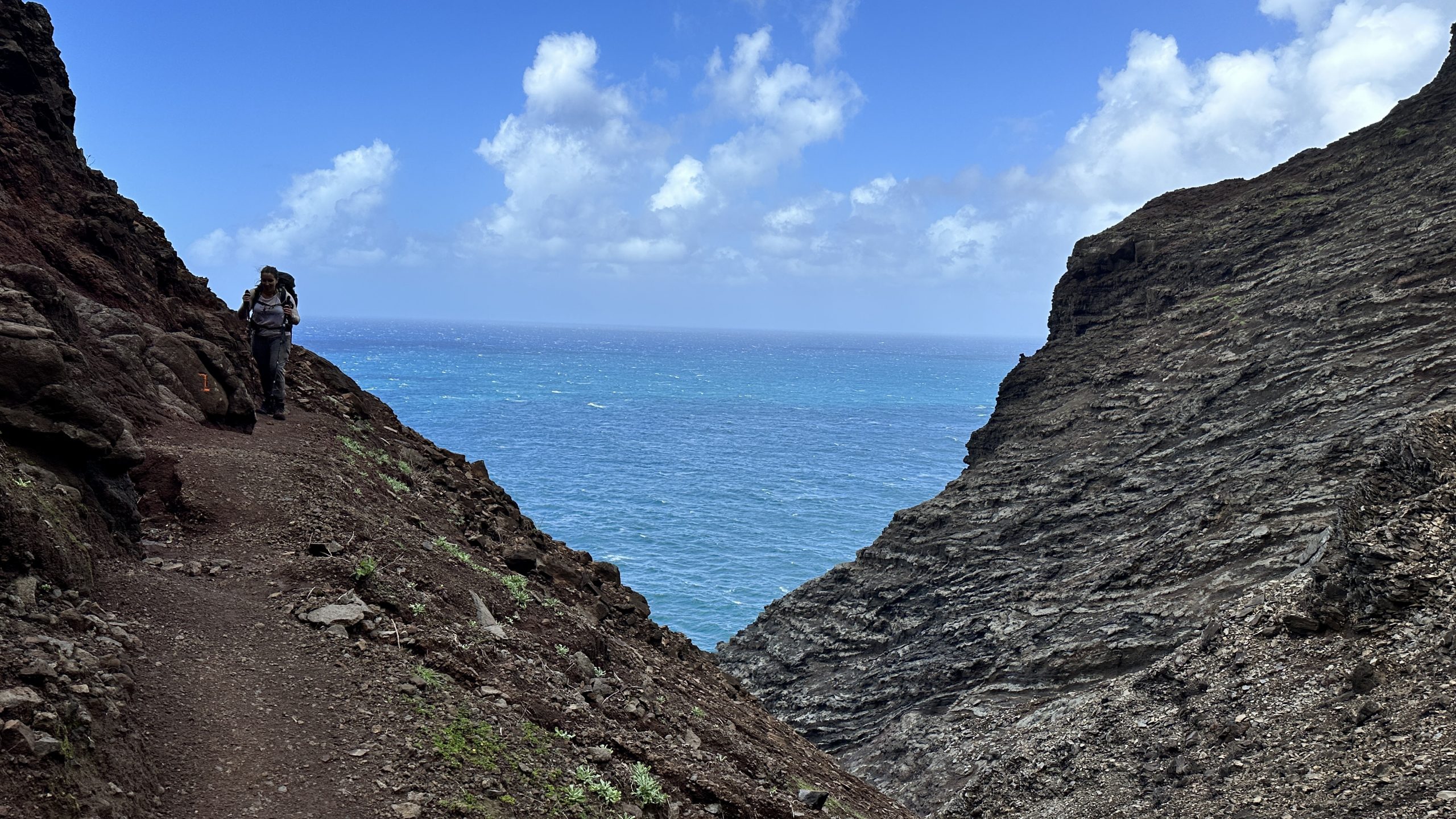
Part 3 – The sketchy bits and Crawlers Ledge
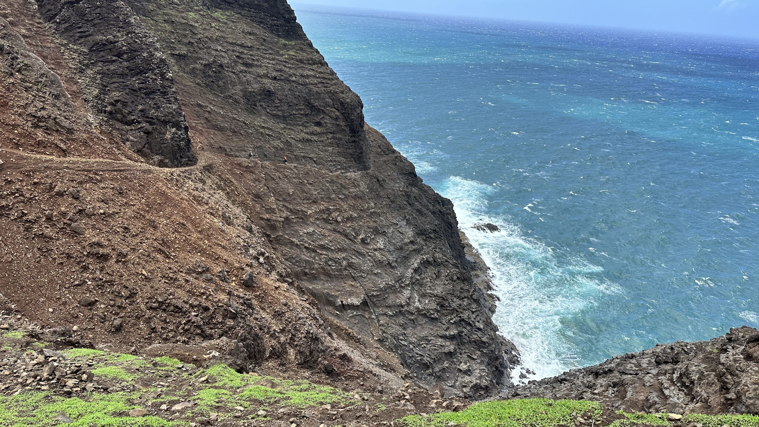
After a lot of green, mud and some switchbacks, Mile 7 brings about the dreaded Crawlers Ledge.
On it’s own, it’s not that bad.
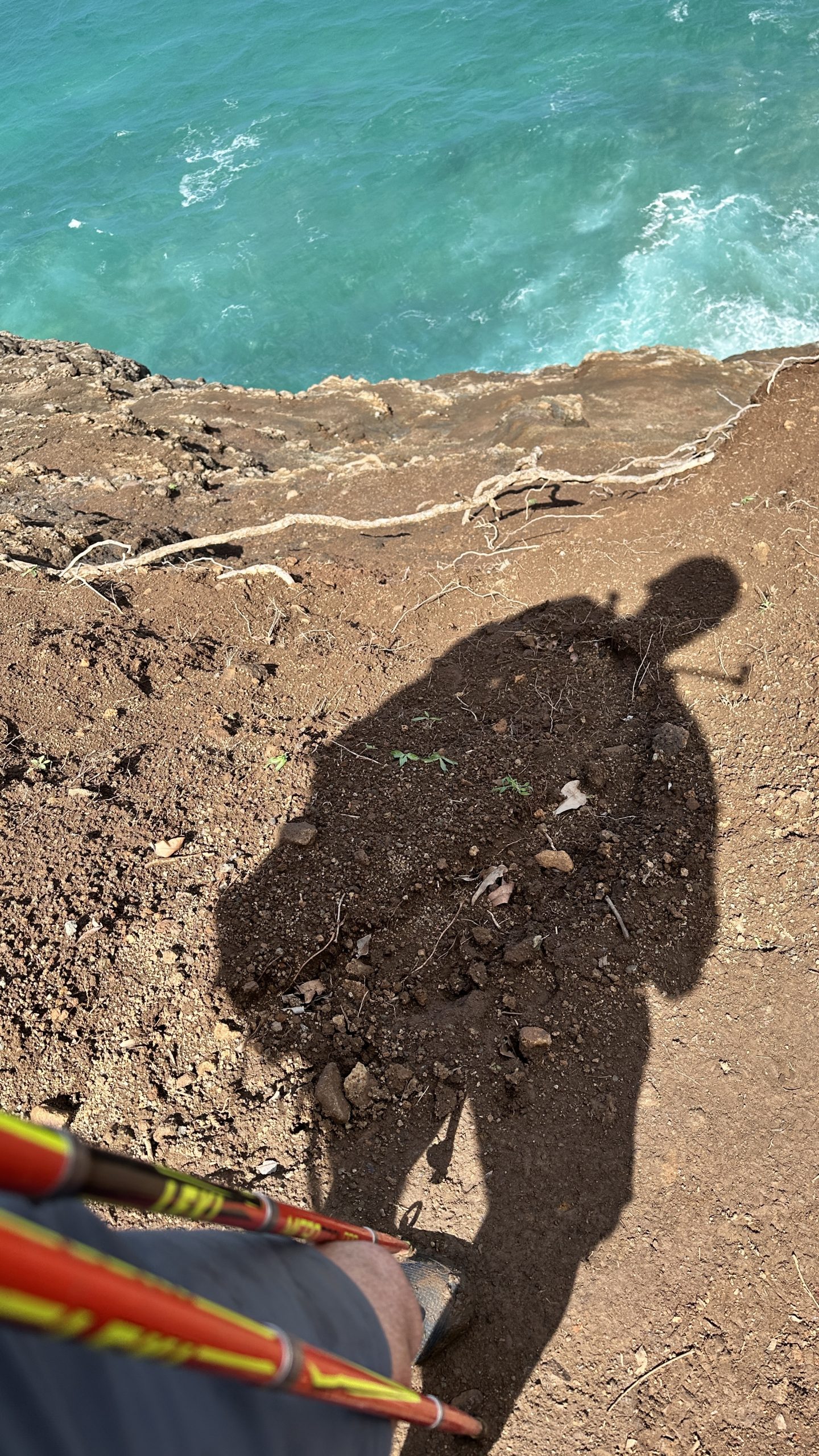
There is zero protection, no ropes, cables etc. but one can lean against the rock avoiding the edge of the narrow ledge that is the path.
It is narrow enough that if an oncoming hiker approached, it would be a problem. You may bounce off the rocks once or twice before free falling into the ocean – roughly 150 meters below. Not good!


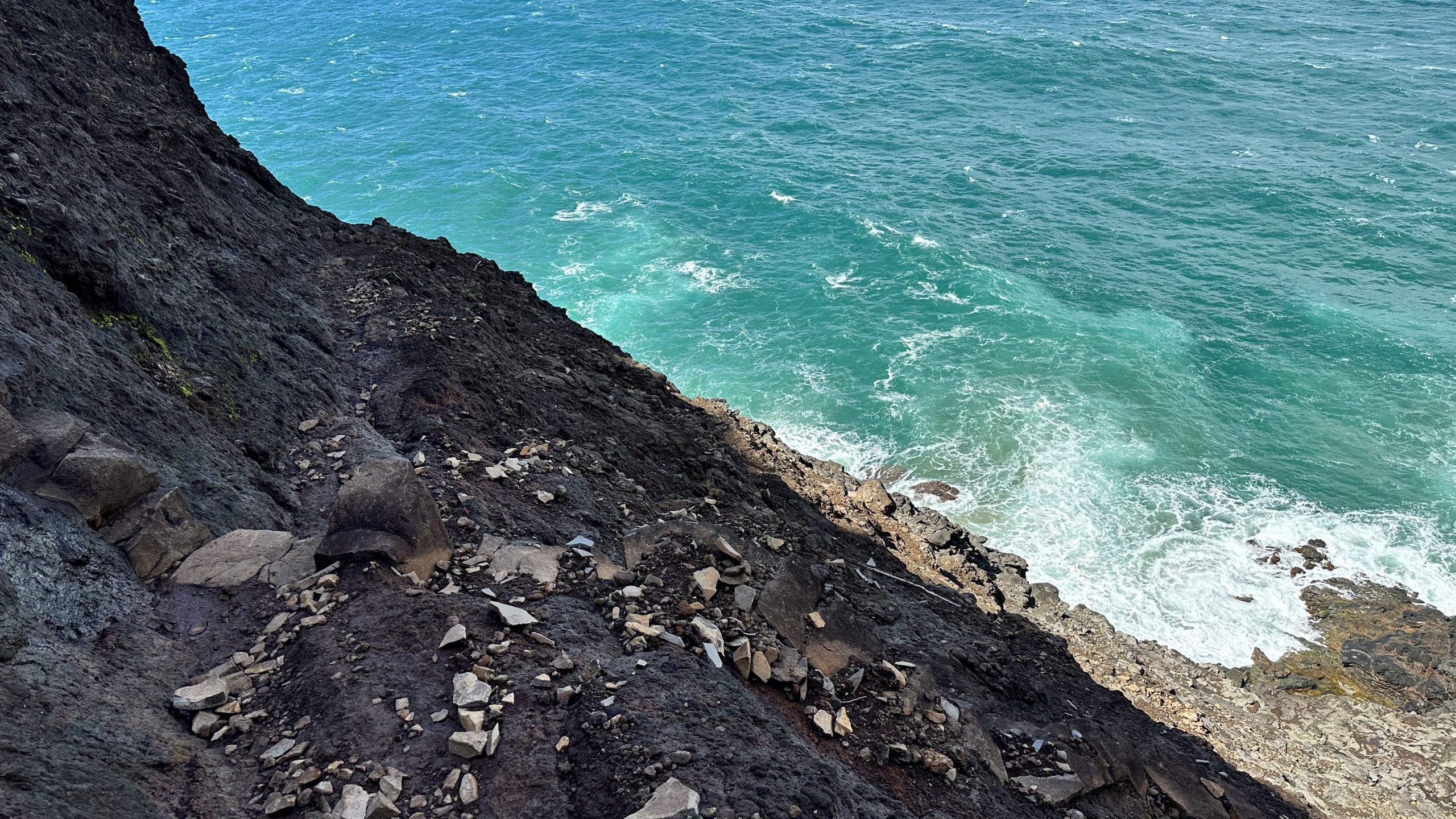
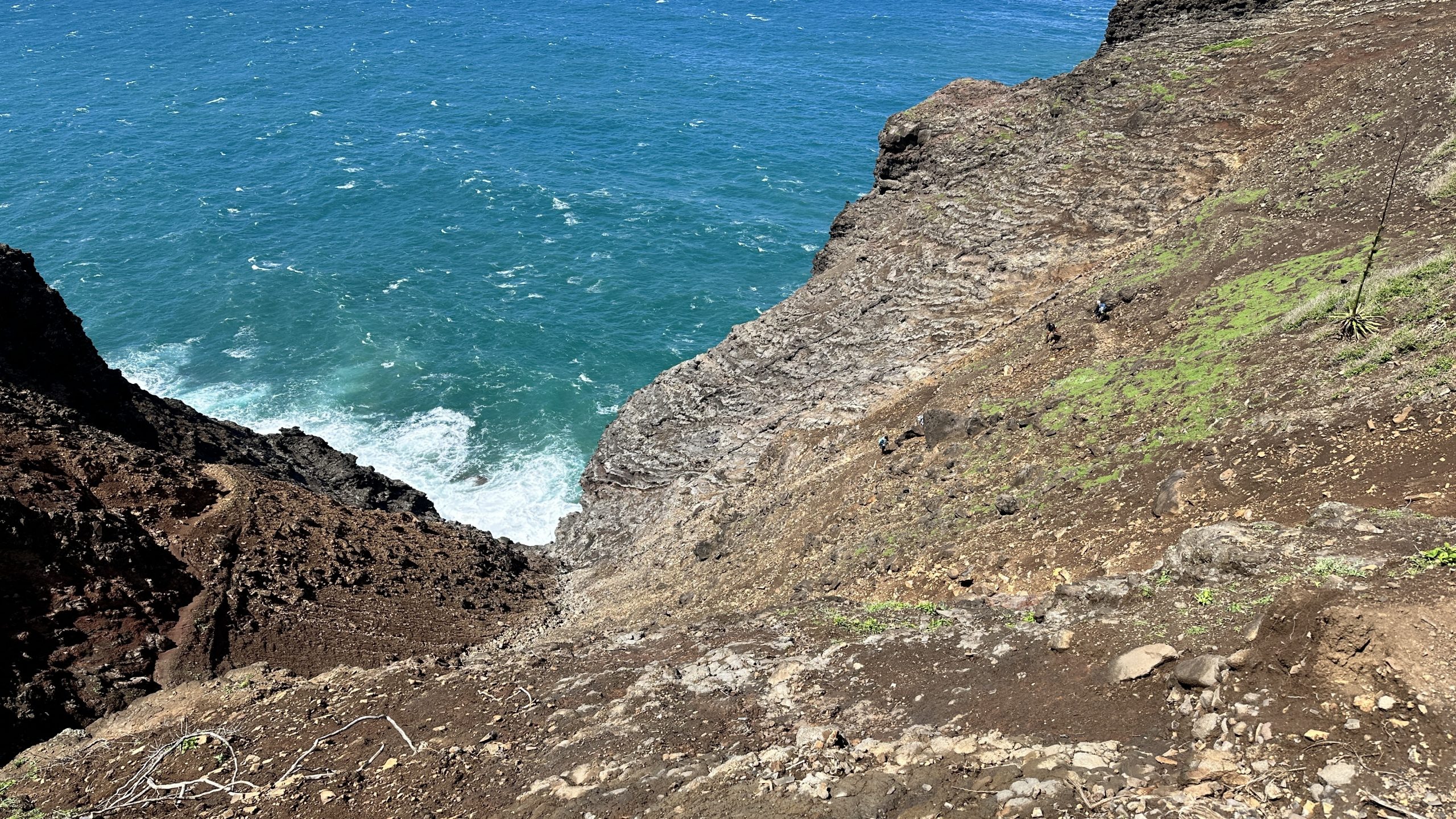
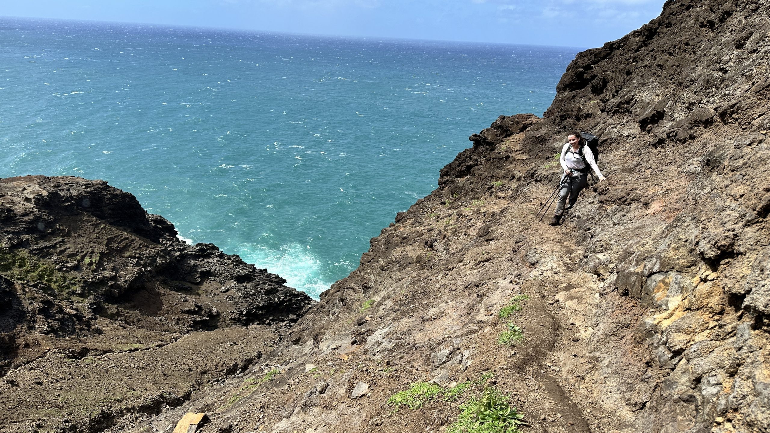
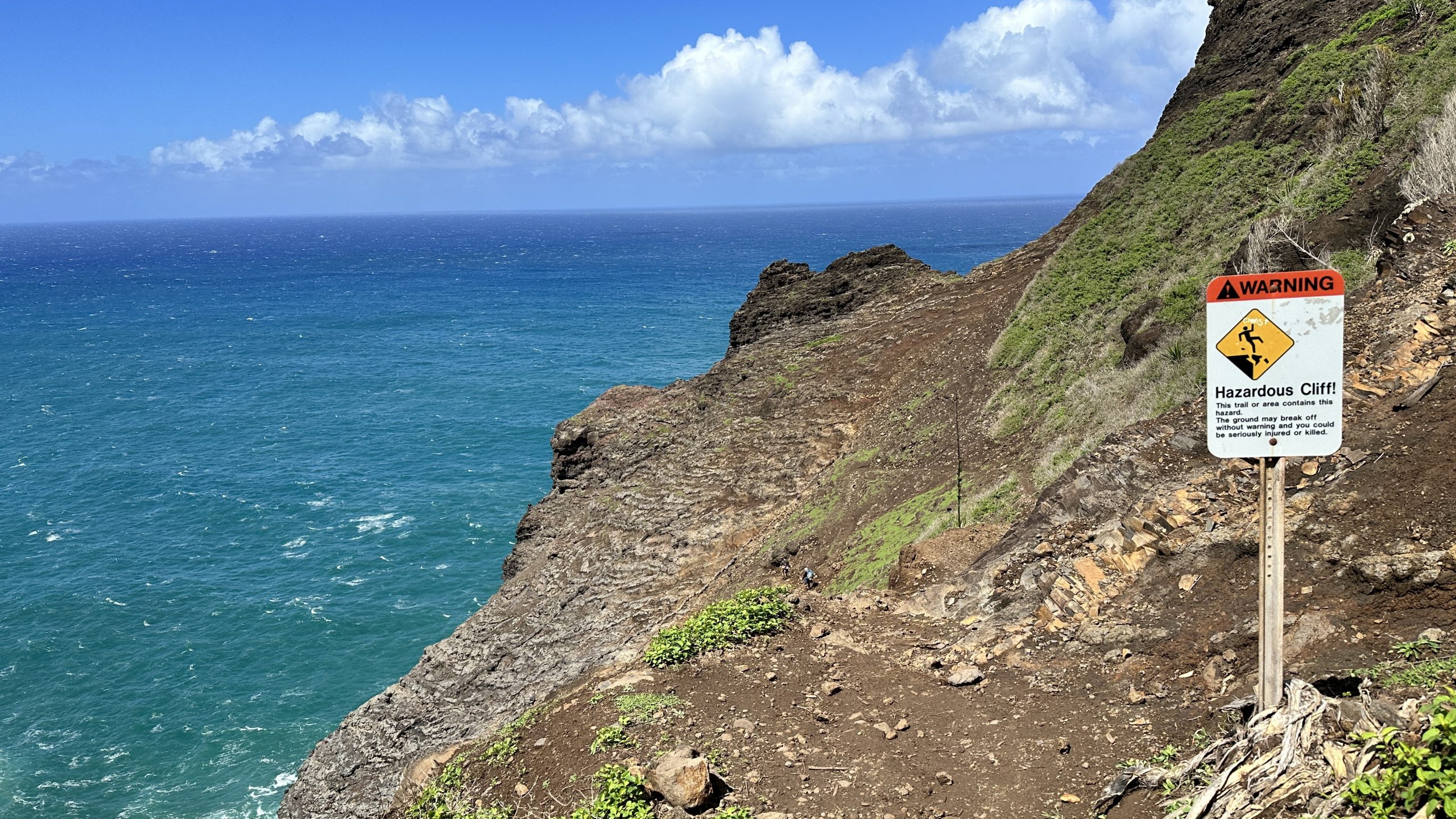
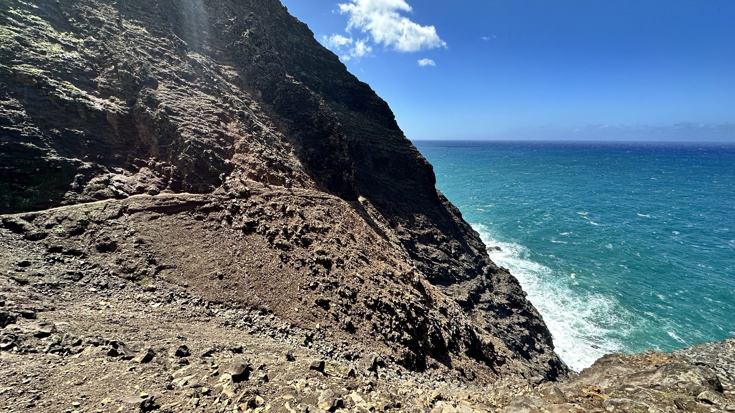
What complicates this section is the wind and rain. It adds another element of necessary caution.
Immediately after the ledge there is a dirt section which on our day, turned some people back due to it being so slippery.
On the positive side, it is easy to lean against the rock face – use your poles for extra support and slowly take it step by step. No problem. Just be careful.
A decent guideline is that if you were uncomfortable during mile 4 to 5, turn back. Mile 7 is much more intense.
On our way in and out we were lucky that while windy (much more windy on the way back) the trail had a bit of afternoon sun and the mud had a bit more stick to it. Definitely a help.
I did not feel comfortable enough to take any photos during the sketchy ledge bits.
Part 4 – Getting lost and arriving
After the ledge section and the muddy cliff section, we felt that the worst was behind us. We were wrong.
The trail continues to punish you step by step, via the weather the mud, the constant elevation changes and in our case, a missed left turn.
Where we should have turned left, we went straight. It looked like trail, it wasn’t – it was a dead end with some squatters tents in the area.
My map showed that if we clambered up a slope we should intersect with the trail. We tried and failed. Most likely we were within 20m of the trail but the pitch was simply too steep, the slope too wet, offering no traction whatsoever – we were in danger of bad things happening.
In addition, valuable time was being lost and while we only two miles or so to go, it was getting close to the end of daylight.
We ended up descending the slope and aimed to intersect the trail via a shorter slope. Upon gaining the top of that slope, we intersected the trail and were back on track.
The cost? Just over an hour of super stressed exertion welded to the anxiety of not knowing exactly where you are in fading daylight.
It was on the return trip we saw where we made our mistake. A log over the trail with a “Left” carved into it. I ducked under the log, Kristin missed it.
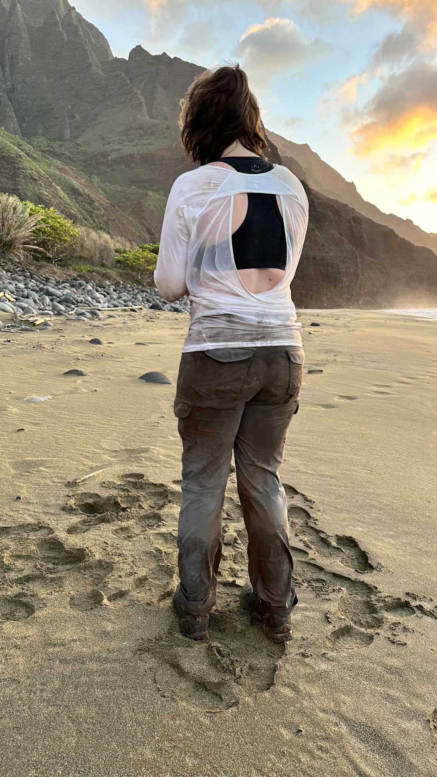
Once back on the trail we painfully, exhaustedly, finished the last two miles. Straightforward, albeit painful descending, due to a long day and the extra exertions while being lost.
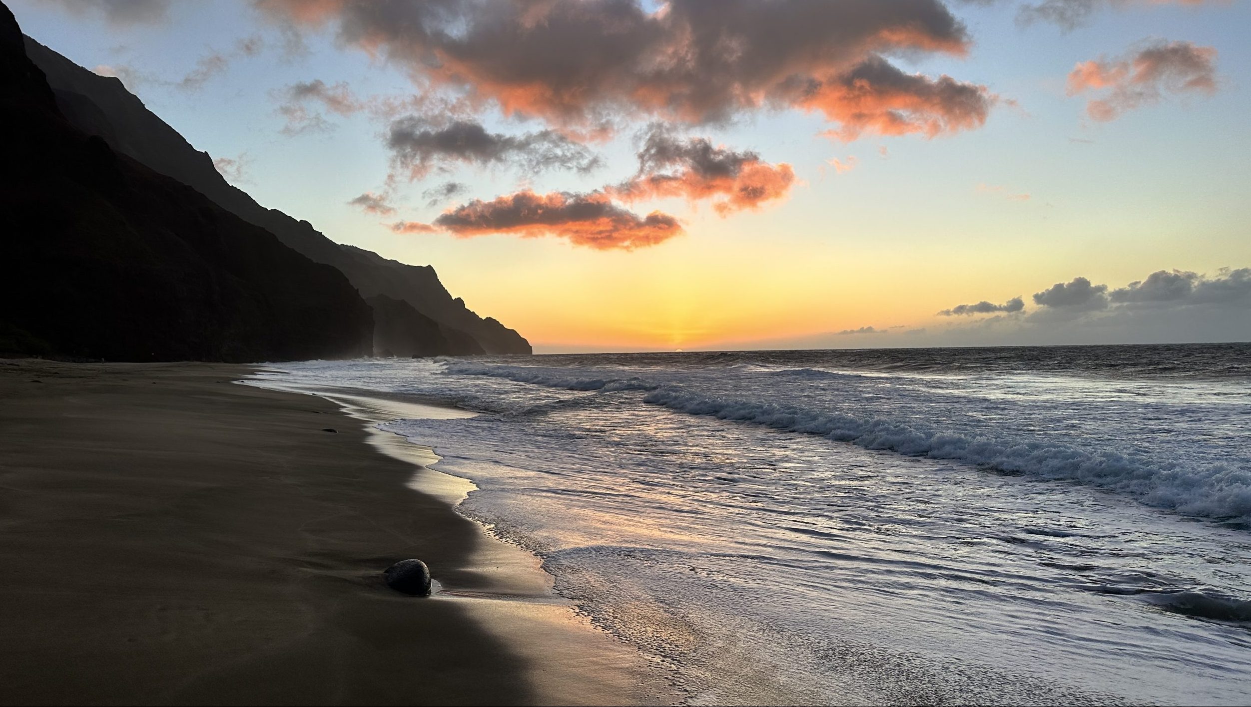
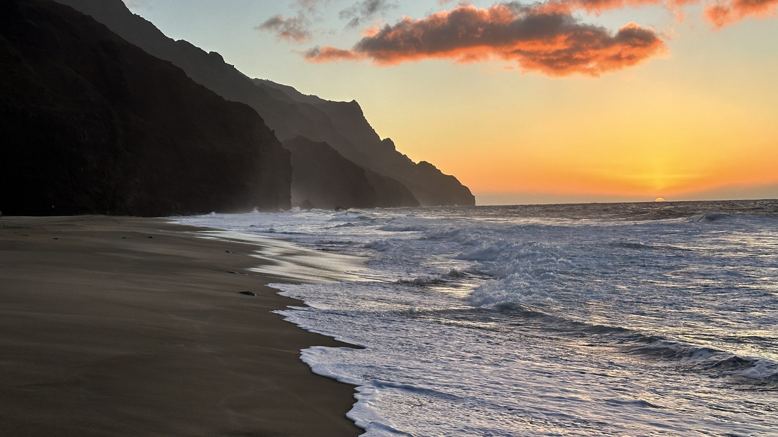
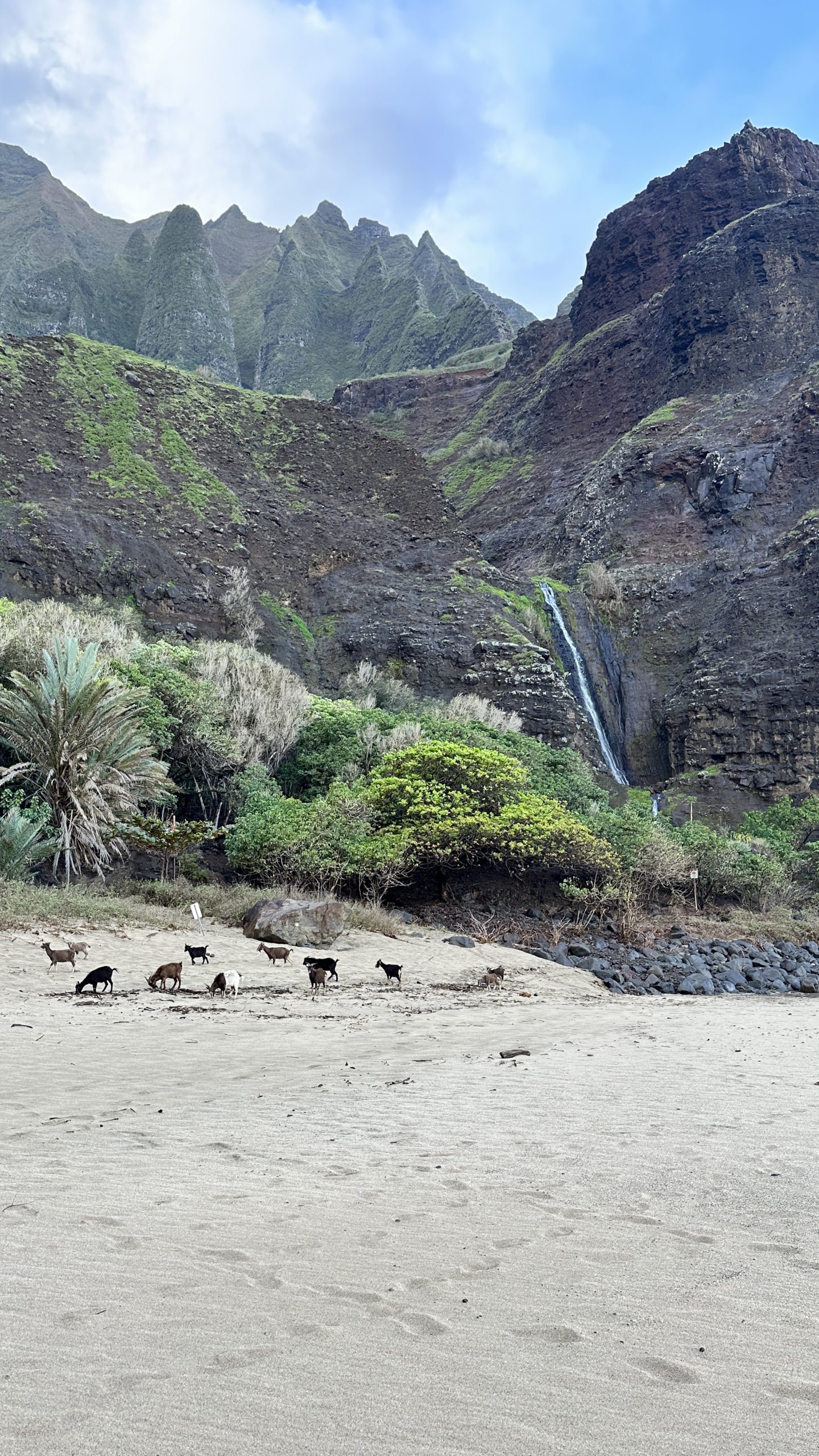
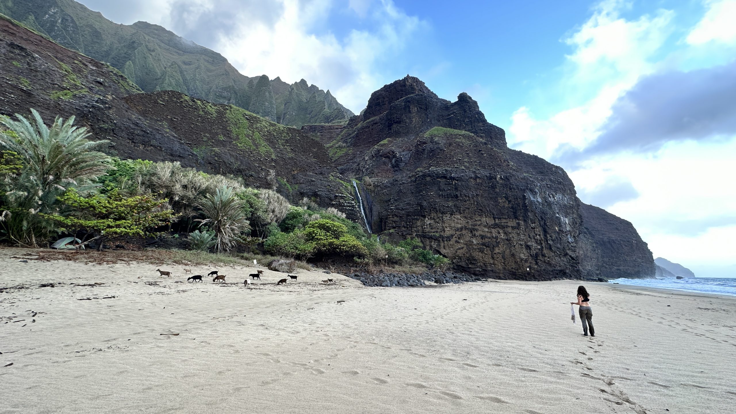
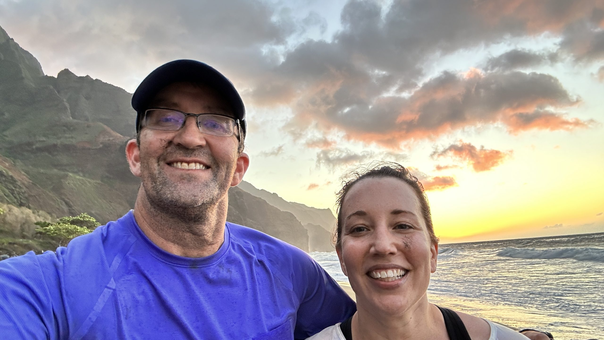
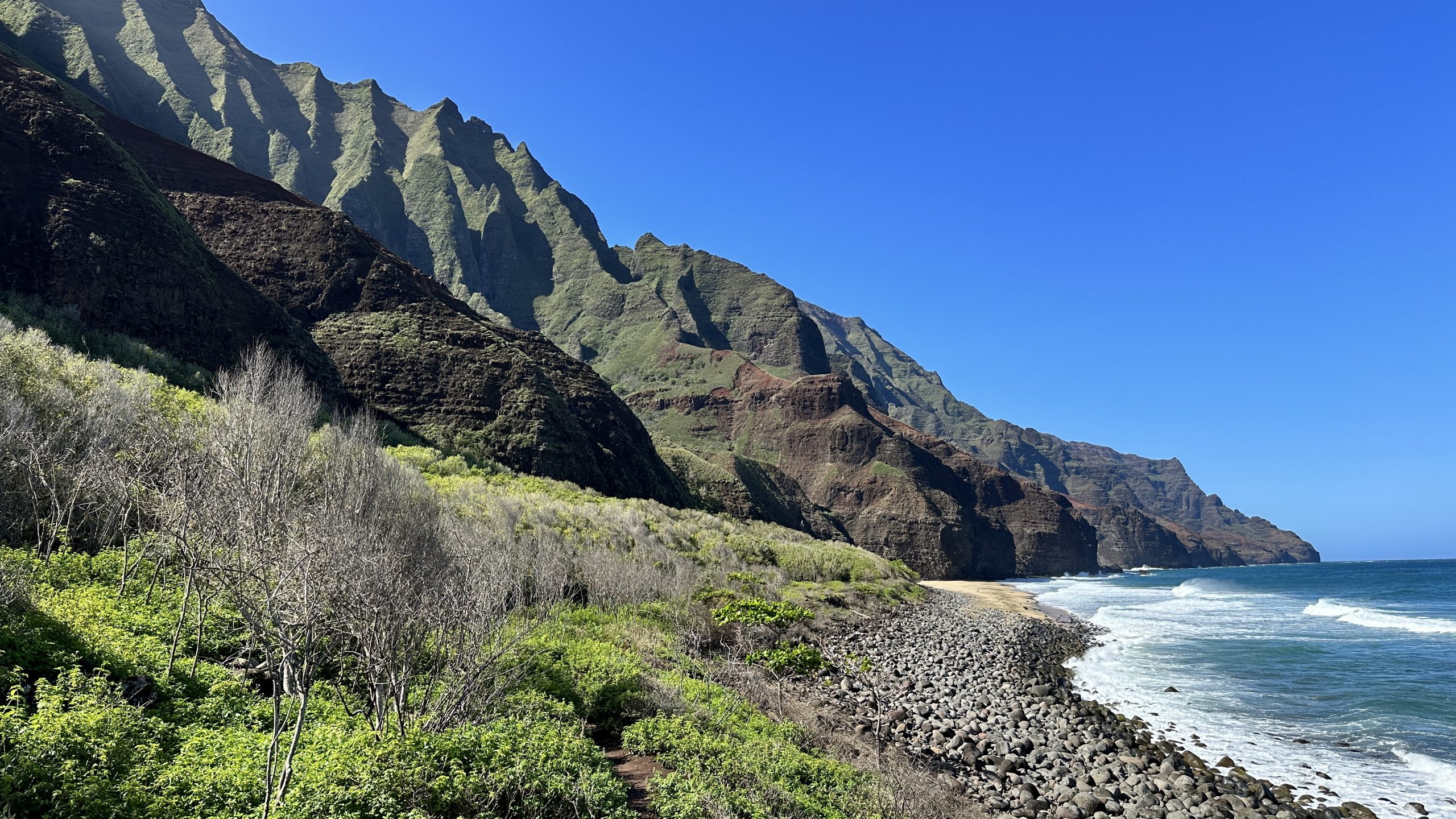
It was all worth it however. We made the camping area with ten minutes to spare before catching a sunset on the beach by ourselves.
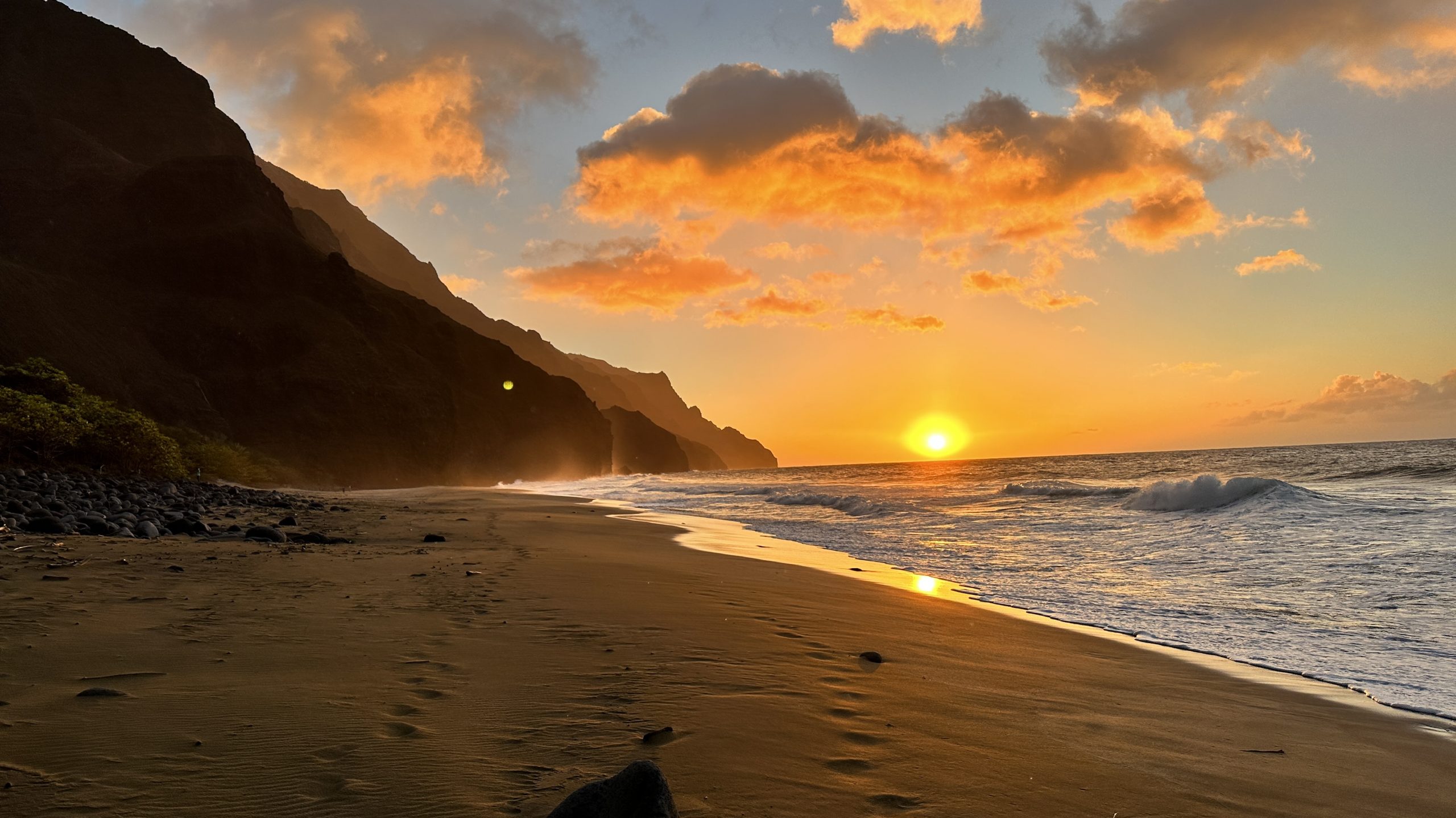
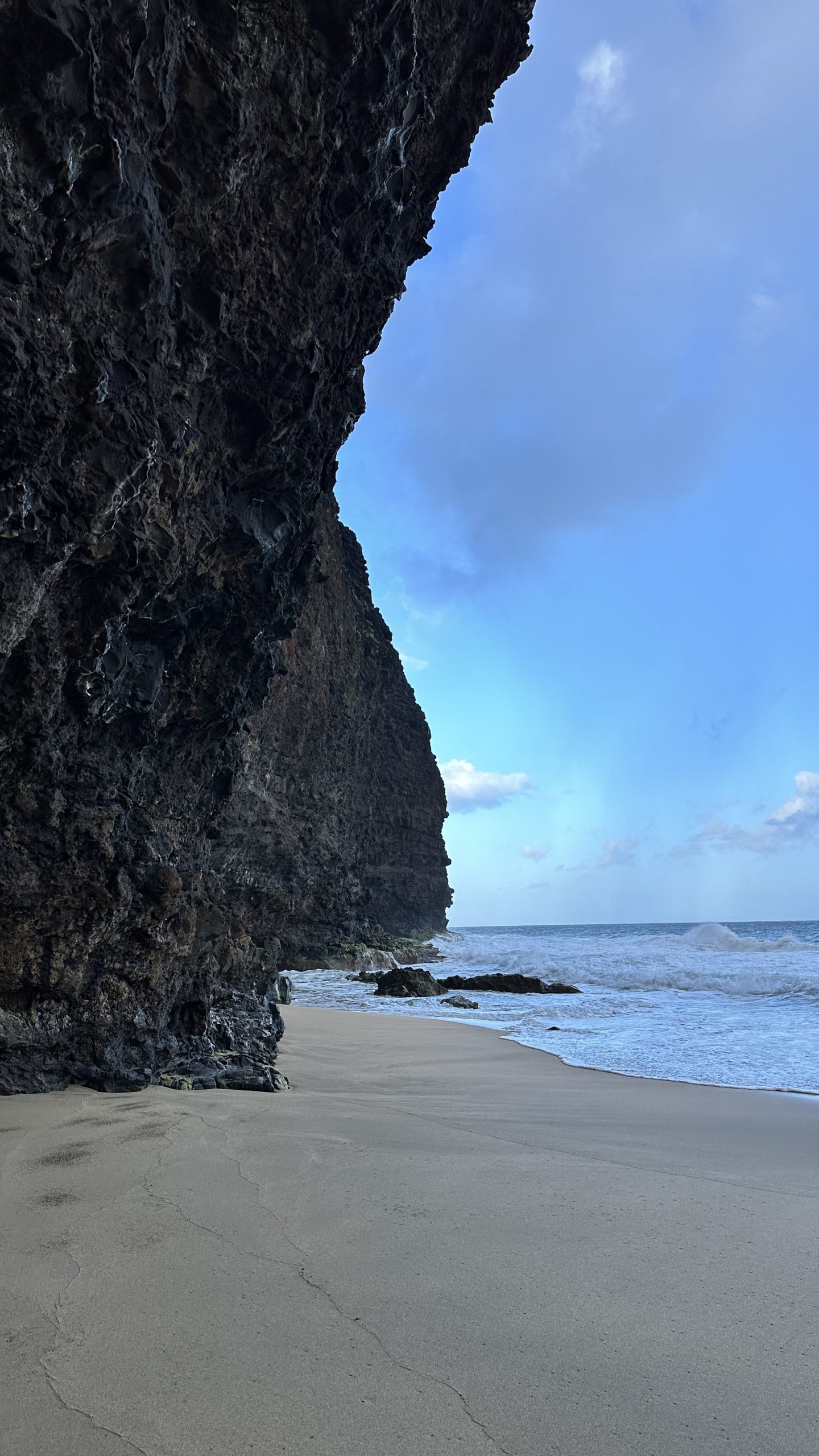
A useful tip would be to collect your water at the last river crossing just before the camping area. If you are really tired it will save you a walk to the far end of the beach for fresh water.
Part 5: Camping and the return
We arrived, very quickly setup the tent for the first time – easy enough, inflated our mattresses and got them into the tent.
The tent had to be fully set up quickly so that we could; catch the sunset on the beach and to prevent it blowing away in the wind and also getting wet with the constant waves of rain.
We had brought several freeze dried meals – Happy Yak – they were uninspired taste wise. Disappointing but they did provide the necessary calories.

Laying in the tent, the mattresses were comfortable, a relief. At the same time spirits were low. Our bodies hurt, every move elicited a cramp and we both felt there was no way we could do that again backwards tomorrow.
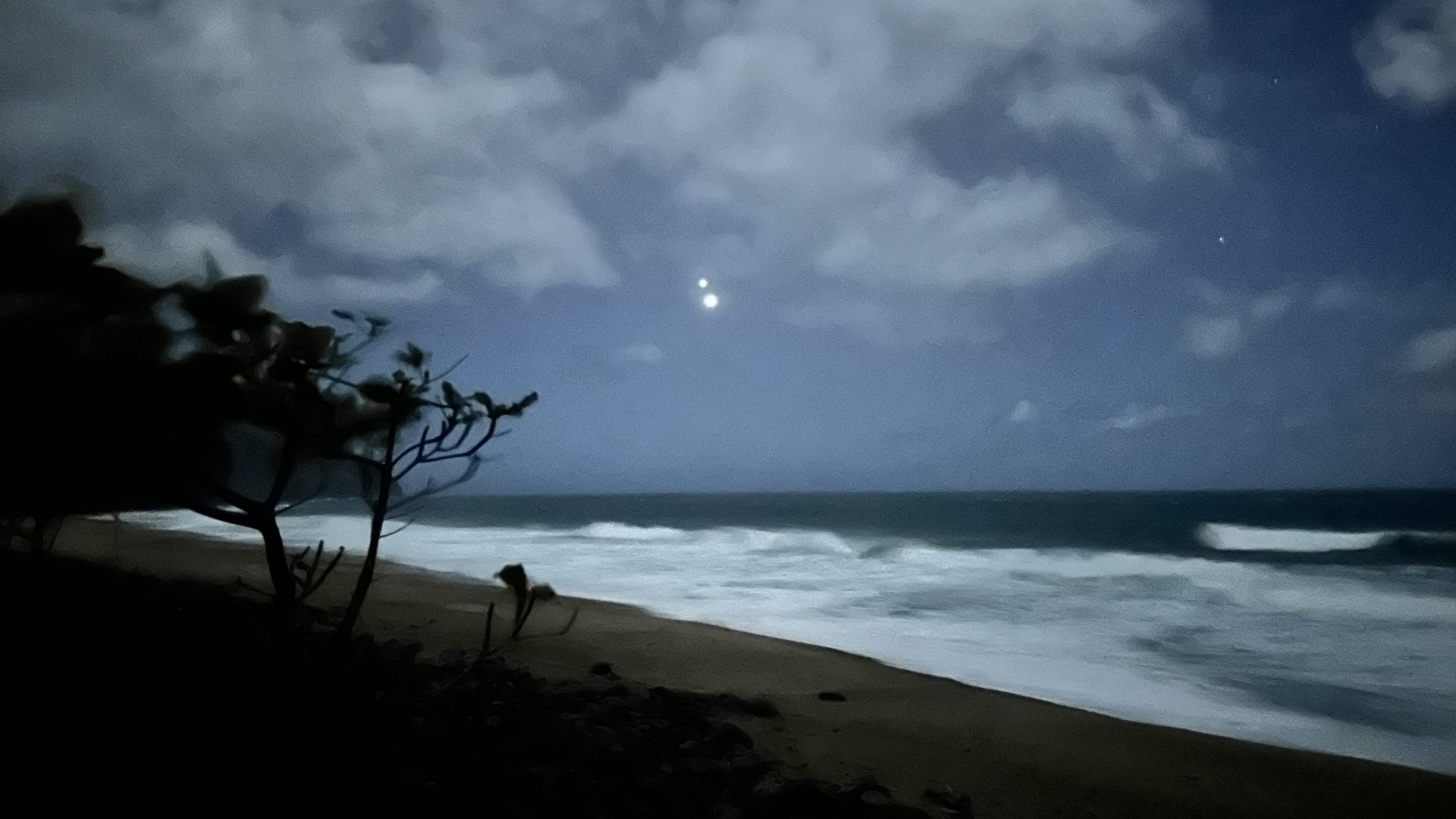
The rain, the violent sounds of the Pacific and the wind made for a very noisy night.
We discussed and agreed on a plan. Leave a bit late, get to the halfway campsites and stay there for the night, breaking up the return journey into two days. Making it a more relaxed trek back to the real world.
While we did not sleep much, we were comfortable and rested well.
In addition to the jet engine like sound of the surf, there was the wind and lashings of rain against the tent fly all night and into the early morning.
Our shoes and socks stayed wet, there was no drying overnight.
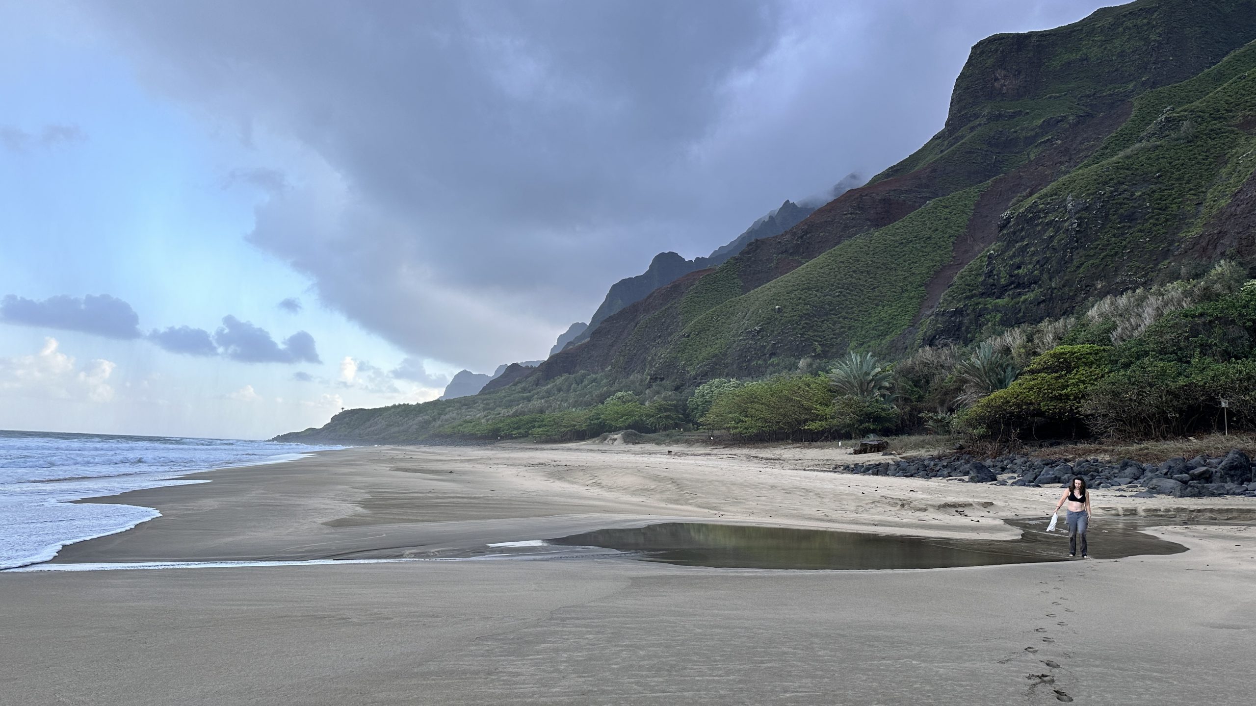
We cooked up some brekky with our wonderful little stove, among the intermittent rain; had a nice gap where the sun actually came out – allowing us to pack up without getting stuff wet.
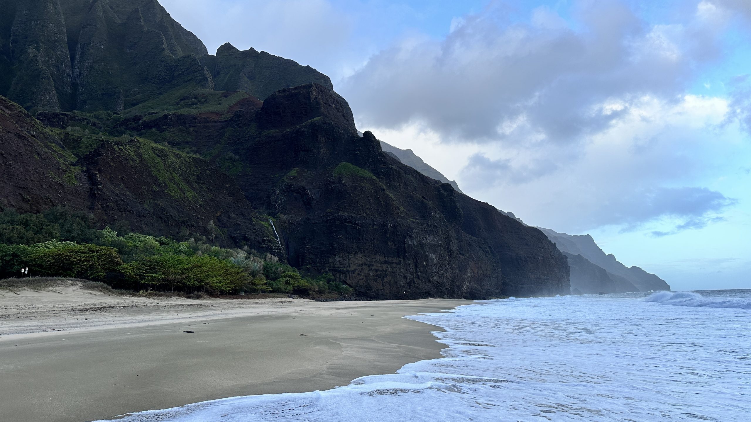
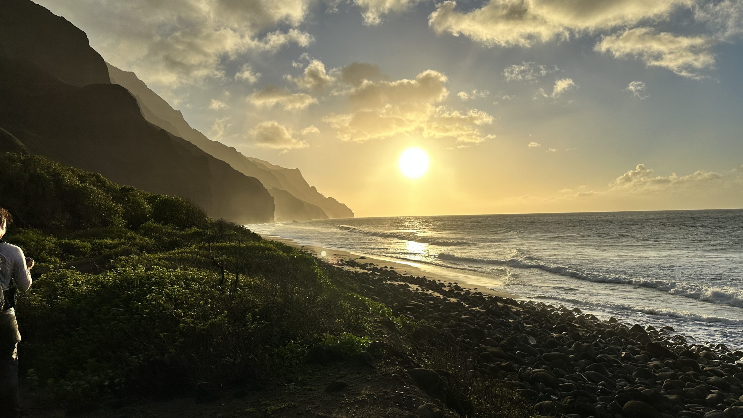
Packed up, we wandered around the beach for a bit, the weather surprisingly sunny. It was good to see the rest of the beach – we were simply too tired and too late to see the night before.
We began our return trek at 10:05am, physically feeling better than expected.
In addition we began the trip back with more than two hours of consecutive sunshine. This allowed the mud to dry a bit on the ledges and gave us dry passage through the Crawlers ledge section.
We hit the mid point campsite early and looking at the clock and listening to our bodies, decided to forge ahead and avoid another night of almost certain miserable camping.
From the halfway point we slogged through the mud, buoyed by the thought of a good meal and a good night sleep. We stayed on time and reached the final two miles with lots of time to exit in daylight.

We made our last river crossing and saw daytrippers. We were close. That being said, the final two miles were a complete and utter slog and it seemed to take forever until we reached the parking lot.
Done.
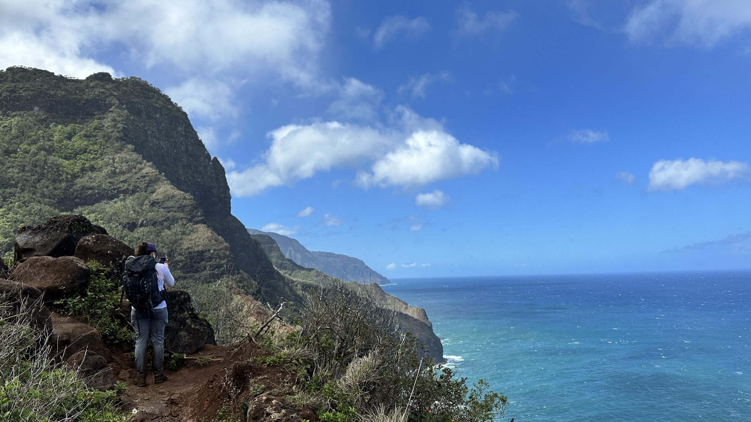
The trail is beautiful in an iconic way. Ideally I feel it would be more enjoyable to do it in the summer with better weather.
It would have been nice to have more time at the end, to get into the water, to not constantly fret about the waves of rain. There is no doubt however that it is an accomplishment, the hike makes you pay one way or another almost every step.
It is isolated, not crowded, dangerous and should not be underestimated. All positives in my mind. There are places where a bad step kills you. There are more places where a bad step just leaves you really damaged.
Totally worth it though and the bad weather, the mud, getting lost and doing the way we did it was perfect. Should we ever do it again however, it will be in the summer. Never again during the winter season!